
Gaumukh Tapovan Trek

Region
Uttarakhand

Duration
6 days

Max. Altitude
14600 ft.

Trek Distance
45 kms

Grade
Moderate to difficult
Fixed Departures
October -2026
- 21 Oct - 28 Oct
- Open
May - 2027
- 1 May - 8 May
- Open
- 9 May - 16 May
- Open
- 17 May - 24 May
- Open
- 26 May - 2 Jun
- Open
June - 2027
- 4 Jun - 11 Jun
- Open
- 13 Jun - 20 Jun
- Open
Highlights
- Services from Gangotri to Gangotri
- Pickup & Drop Location (if transport opted) : Prince Chowk, Dehradun
- Pickup : 06:00 AM | Drop : 06:30–07:30 PM (weather/road dependent) Keep a buffer day and arrive a day early to avoid delays.
Add-ons
- Transport
- Rs 3000/- Per Person
- Offload
- Rs 3700/- Per Person
Add on information
- Insurance is mandatory.
- It is available for Indian citizens only.
- Non-Indians have to take insurance on their own.
- The cancellation policy will be implemented in accordance with the trek cancellation policy.
- Transportation: Dehradun to Gangotri & return is optional.
- Choose add-ons during booking. If missed, you can contact us to book the same.
- Book transportation at least 10 days before the trek.
- Cancellation 6 or more days before the start of the trip results in a 100% cash refund.
- Cancellation less than 4 days from the start of the trip results in a 50% cash refund.
- Cancellations made on the trip date are not eligible for a refund.
- Backpack offload is optional.
- Choose add-ons during booking. If missed, you can contact us to book the same.
- Book off-load at least 10 days before the trek.
- For offline bookings at the base camp, a variable convenience fee may apply. (It differs from trek to trek)
- Offload can't weigh more than 10kg. Offload should have a waterproof cover. Suitcases/trolleys will not be allowed.
- In the event that you choose to cancel your trek prior to the departure date, you will receive a full refund.
- Note : The bag weight should not exceed 10 kg.
Gaumukh Tapovan Trek Overview
- Trek Name : Gaumukh Tapovan Trek
- Days : 6
- Adventure : Trekking
- Base Camp : Gangotri
- Season : Summer | Autumn
- Months : May | June | September | October
- Country : India
- Altitude : 14600 ft
- Grade : Moderate to Difficult
- Trail Type : Point to point trail | Camping at the same location upon returning.
- Food : Meals while on trek & at Hotel/Guesthouse (Veg)
- Location : Uttarakhand
- Distance : 40 km
- Rail Head : Dehradun
- Stay : Camping (Twin sharing) & Hotel/Guesthouse : triple, quad, dormitory (separate for male and female)
- Airport: Jolly Grant Airport, which is 28 km away from Dehradun
Why is Gaumukh Tapovan a Must-Do Trek ?
- Experience the spiritual charm of Gangotri, where the sacred Ganges River begins amidst breathtaking mountains.
- Visit Gaumukh, the source of the Ganges River, where the Bhagirathi River flows out of an impressive ice cave. An unforgettable and spiritual sight.
- Pass through the Blue Pine, Bhojpatra trees area, line on one side, and witness the rugged rocky path and mountain on the other.
- Throughout the trek, enjoy the graceful flow of the river Bhagirathi.
- Explore the vast high-altitude meadows of Tapovan, known for grasslands, grazing mountain goats, and a serene environment perfect for meditation and reflection.
- Marvel at the sight of Mt. Shivling, often considered one of the most beautiful mountains in the world.
- Navigate through rocky paths, boulder fields, and glacier sections and enjoy a varied and engaging hiking experience.
- Take in breathtaking views of the famous Himalayan peaks, including the Bhagirathi - I, II, III, Mt. Meru, and the grand Mt. Shivling, all surrounding you in the grand landscape.
Major Attractions
- Gangotri : The starting point of the trek, Gangotri is a bustling pilgrimage town home to the famous Gangotri Temple dedicated to Goddess Ganga. It’s a place where you can soak in the spiritual atmosphere and explore the ancient traditions tied to the river Ganges.
- Chirbasa : Named for its abundant Blue Pine trees, Chirbasa is the first major stop along the trek. It covers the stunning views of the Bhagirathi River and surrounding pine forests, creating a serene backdrop for trekkers.
- Bhojwasa : The next stop is Bhojwasa, a barren but beautiful area named after the Bhojpatra trees that flourish here. With its open skies and the Bhagirathi River flowing nearby, is a peaceful spot to rest and acclimatize before heading towards Gaumukh.
- Gaumukh : Reaching the Gaumukh Glacier is a profound moment on the trek. Standing at the snout of the glacier, you’ll witness the Bhagirathi River emerging from the ice, marking the sacred beginning of the Ganges. Truly the essence of the moment.
- Tapovan : Tapovan, a high-altitude meadow at the base of Mount Shivling, is renowned for its serene beauty and stunning views of the surrounding peaks. This peaceful spot serves as a meditative retreat for many. It’s a place where you can feel the spiritual energy that has drawn sages and seekers for centuries.
- Shivling Peak : One of the most iconic and visually striking peaks in the Himalayas, Shivling stands tall with its pyramid-like shape piercing the sky. Mt. Shivling is often described as one of the most beautiful mountains in the world.
History and Mythology of Gaumukh Tapovan Trek
Beyond the stunning beauty and formidable heights, the Himalayas are steeped in layers of mysticism, spirituality, and tales that have been passed down through generations. The Gaumukh Tapovan trek is not just about stunning landscapes and trails; it’s also a journey into the rich Hindu mythology. The glacier at Gaumukh, shaped like a cow’s mouth, marks the sacred source of the Ganges River, known as the Bhagirathi at this point.
According to ancient legends, King Bhagirath performed intense penance to bring the river Ganga down to earth to purify the ashes of his ancestors. Moved by his devotion, Goddess Ganga agreed to descend but warned that her powerful flow could devastate the earth. To mitigate her force, Lord Shiva caught Ganga in his matted locks, allowing her to flow gently from the heavens, thus beginning her journey at Gaumukh.
This divine descent of the Ganga symbolizes purification, redemption, and the unending flow of life. Pilgrims believe that the waters of Gaumukh carry a powerful spiritual energy which makes this trek not just a physical journey, but a spiritual pilgrimage to the very origins of the holy Ganges.
Eligiblity for Gaumukh Tapovan Trek
- Age Requirement : Minimum 14 years
- First-timers are welcome, though prior trekking experience is preferred. Good fitness is a must.
- Fitness Criteria :
- The Trekker should have sufficient stamina to cover 5 km of distance by jogging in 30 minutes without stress or 10 km of distance in 70 minutes without stress
- If the trekker prefers cycling he/ she should be able to cycle 18 km of distance in 50 minutes.
- If the trekker wants to carry a backpack then he/she should be able to carry a 10-12 kg backpack. If opt Off-load option then the trekker should be able to carry 3-5 kg backpack.
- If a trekker's BMI is more or less than the normal range (18-27), please consult our Trek Coordinator before booking.
Gaumukh Tapovan Trek Itinerary
01. Dehradun To Gangotri
- Altitude: 3,100 m/ 10,200 ft.
- Drive distance: 240 km (8-9 hours).
02. Gangotri to Bhojbasa
- Altitude: 3,800 m/ 12,500 ft.
- Trek Distance: 14 km | 8-9 hours.
- Gradual ascent & packed lunch
03. Bhojbasa to Tapovan
- Altitude: 4,450 m/ 14,600 ft.
- Trek Distance: 9 km | 7-8 hours.
- Packed lunch
04. Tapovan to Bhojbasa via Gaumukh
- Altitude: 3,800 m/ 12,500 ft.
- Trek Distance: 8-10 kms | Duration: 6-7 hours.
- Steep descent till Gaumukh, packed lunch
05. Bhojwasa To Gangotri
- Altitude: Tapovan - 3,200 m/ 10,200 ft.
- Trek Distance: 14 km | Duration: 7-8 hours.
- Gradual descent, packed lunch
06. Departure to Dehradun
- Drive Distance: 240 km | Duration: 8-9 hours.
- After morning tea towards Dehradun.
- Reach Dehradun by 5 to 6 Pm.
Note:
- Keep a buffer day in your travel plan.
- If buffer day is not used in the travel then it can be used to Explore Dehradun.
- Distance, Altitude, and Trekking hours are approximate and rounded off.
- Keep the original and copy of ID proof handy.
- Come one day early if planning to come by plane.
Dehradun To Gangotri
- Altitude : 3,100 m/ 10,200 ft.
- Drive Distance : 240 km | 9-10 hours
- Accommodation : Guest House
- Pick-up time : Prince Chowk, Dehradun | 6 am.(If transportation opted from WTM)
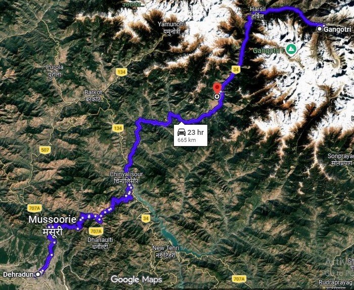
The journey starts early in the morning from Dehradun, a lively city known as the gateway to the Uttarakhand Himalayas. Departing at 6 am from Prince Chowk, you’ll embark on a scenic drive through the heart and soul of Uttarakhand. As you travel, you’ll pass through valleys, with towering mountains on either side. The route is also dotted with sparkling water streams and beautiful waterfalls that add to the beauty of Uttarakhand.
After 35 km from Dehradun, your first major attraction will be Mussoorie, a famous hill station, often known as the “Queen of Hills,” which shows the majestic views of the Shivalik Ranges and Doon Valley. Perched at an altitude of about 2,000 metres, the town is famous for its mist-covered hills, colonial architecture, and vibrant markets. Key attractions include Kempty Falls and the Mussoorie Mall Road. We’ll take a break on the way to savour breakfast and immerse ourselves in the beauty of the surrounding sights. As the drive progresses, you’ll arrive at Uttarkashi, a spiritual town nestled along the banks of the Bhagirathi River. It is known for its rich cultural heritage, ancient temples, and ashrams. It is a revered destination for pilgrims and trekkers alike. The town is home to the famous Kashi Vishwanath Temple, dedicated to Lord Shiva, and serves as a gateway to many Himalayan treks. Further along the route, you will pass through Harsil, a village on the banks of the Bhagirathi River. Known for its dense deodar forests, apple orchards, and charming wooden houses, Harsil provides a tranquil escape and is often described as one of Uttarakhand’s hidden gems.
Continuing from Harsil, you’ll drive along the banks of the Bhagirathi River, where the sound of flowing water adds to the serene ambiance, making each moment on the road a visual treat. As you approach Gangotri, the scenery becomes even more captivating, setting the perfect tone for the trek ahead. Once you arrive, you can settle into your accommodations and take in the serene ambiance of Gangotri. The Gangotri Dham is Known as the spiritual origin of the Ganges River. The town is surrounded by snow-capped peaks and vast forests and provides a tranquil atmosphere.
Gangotri to Bhojbasa
- Altitude : 3,800 m/ 12,500 ft
- Accommodation : Tent
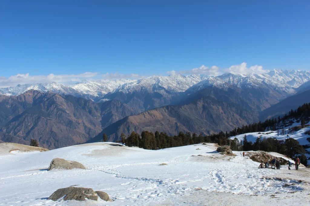
In Gangotri, some of the most captivating sights that greet you are Mt. Sudarshan and Mt. Thelu, standing majestically in the distance. The mountain is not only a visual delight but also a symbol of the grandeur of the Himalayas. After a hearty breakfast, you can explore the sacred town surroundings.
As trekkers leave behind the scenic ambiance of Gangotri and then Chirbasa, they find themselves immersed in a surreal landscape adorned with lush Birch (Bhojpatra) forests. The trail meanders alongside the Bhagirathi River, offering intermittent glimpses of its mighty flow and the imposing Bhagirathi Massif towering in the distance. Upon reaching Bhojbasa, trekkers are rewarded with a spectacular view of the Bhagirathi Massif dominating the horizon. Set against this majestic backdrop, the campsite at Bhojbasa offers a perfect vantage point to marvel at the magnificence of the Himalayas.
Bhojbasa to Tapovan
- Altitude : 4,450 m/ 14,600 ft
- Trek Distance : 9 km | 7-8 hours
- Accommodation : Tent
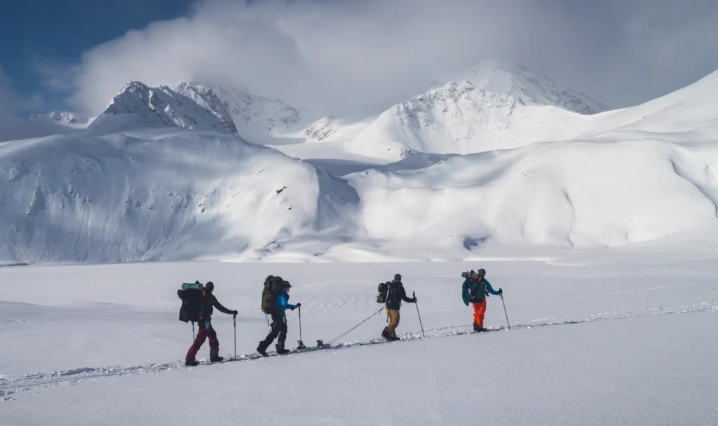
The trek from Bhojbasa to Tapovan is an exhilarating ascent into the heart of the Himalayas, where trekkers are rewarded with views of nature’s grandeur at every turn. Departing from the beautiful campsite of Bhojbasa, trekkers navigate their way through the rugged terrain, with the majestic Gangotri Glacier guiding their path. As they traverse the rocky moraines and steep ascents, the sheer magnitude of the surrounding peaks becomes increasingly apparent, with towering summits casting their shadows over the landscape. Upon reaching Tapovan, trekkers are greeted by a sense of accomplishment and wonder, as they stand in awe of the breathtaking scenery that surrounds them, a testament to the raw power and beauty of nature.
Tapovan to Bhojbasa via Gaumukh
- Altitude : 3,800 m/ 12,500 ft.
- Trek Distance : 8-10 km | 6-7 hours
- Accommodation : Tent
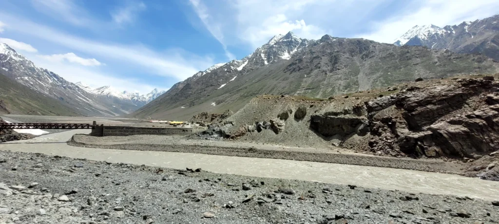
Awakening to the magical morning at Tapovan is a surreal experience, with the towering silhouette of Mt. Shivling and the surrounding peaks casting a majestic spectacle against the canvas of the sky. As the first rays of sunlight cascade over the snow-capped summits, trekkers are enveloped in a golden glow, witnessing nature’s grandeur in its purest form. After soaking in the breathtaking vistas, adventurers embark on a steep descent from Tapovan, navigating rocky trails and cascading streams as they make their way towards Gaumukh, the sacred snout of the Gangotri Glacier. Arriving at Gaumukh, trekkers are greeted by the awe-inspiring sight of the glacier’s terminus, where pristine ice meets the rushing waters of the Bhagirathi River, symbolizing the sacred source of the Ganges.
Bhojwasa To Gangotri
- Altitude : Tapovan - 3,200 m/ 10,200 ft.
- Trek Distance : 14 km| Duration: 7-8 hours.
- Accommodation : Tent/guest house
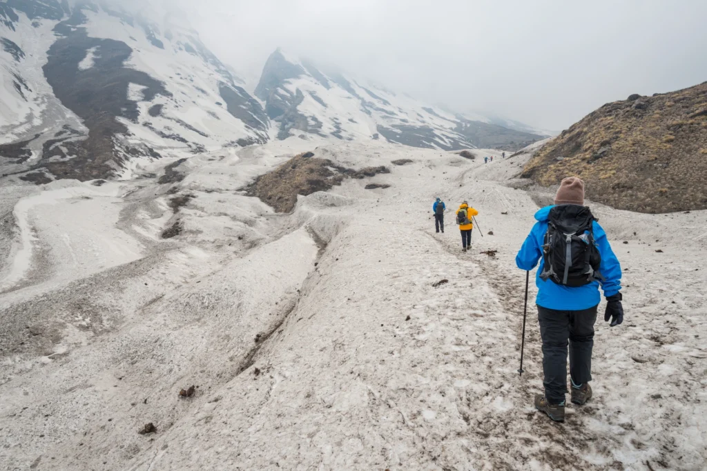
As trekkers bid farewell to the serene campsite of Bhojbasa, they embark on a gentle descent along the familiar trails, retracing their steps through the enchanting birch forests and meandering streams. With each step, memories of the trek flood their minds, from the breathtaking vistas atop Tapovan to the tranquil beauty of Chirbasa. As they approach Gangotri, the snow-capped peaks gradually recede into the horizon, a poignant reminder of the adventures and experiences that have shaped their journey. Upon reaching Gangotri, trekkers find solace in the familiar surroundings, relishing the opportunity to rest and rejuvenate after days of exhilarating trekking.
Departure to Dehradun
- Drive Distance : 240 km | Duration: 8-9 hours.
- After morning tea travel towards Dehradun
It’s time to say goodbye to the mountains! After having witnessed the serene beauty, you will head to Dehradun after morning tea is served. Breakfast and lunch while travelling is not included in the trek cost. You will reach Dehradun by evening 6-7 pm.
Health Awareness
- Pulse rate at rest must be in between (60 to 100 beats per minute).
- Blood Pressure Reading must be in between (DIASTOLIC 75 – 85, SYSTOLIC 100 - 130 mm Hg).
- Respiratory rate at rest must be in between (12 to 20 breaths per minute).
- Should not have Liver and kidney issues.
- Should not have Diabetes Mellitus, Bronchial Asthma, Heart problems, Hypertension, etc.
- No pacemaker implant.
- People with Sinus issues, Epilepsy please contact to trek coordinator before booking the trek.
- If your BMI is not normal, Please contact our Trek coordinator before Trek booking.
Important Links
How to Reach:
Pick-Up Information
- It is essential for everyone to arrive at Prince Chowk, Dehradun (06:00 am).
- Once you have reached Dehradun, WTM will manage the rest of your travel arrangements, if you have opted for WTM's pick-up service, you can select this option during the booking process by adding it as an add-on.
Options to Reach Dehradun
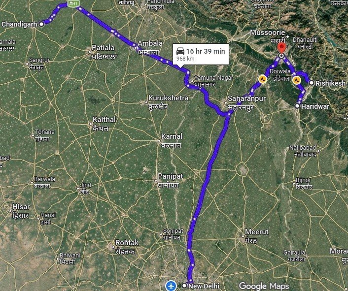
First, you can arrive at Delhi, Dehradun Airport or Chandigarh. The journey from these locations to Dehradun is explained below.
- 1. Take an overnight train from Delhi to Dehradun.
- 2. Take a bus to Dehradun ISBT from Delhi Kashmiri gate ISBT or Chandigarh Sector 17 Bus stand, and then take local transport to the pickup point (Prince Chowk).
- Delhi to Dehradun - 250km | 6hr.
- Chandigarh to Dehradun - 220km | 5hr
- The distance from the Dehradun Bus Stand (ISBT) to the Railway Station is 6 km, without traffic, it will take 15 minutes.
- (We strongly recommend to go for the govt. Buses over the private ones outside the bus station as based on the experience we have found that there are very high chances of delay involved with private buses. Also, govt. Buses are always more reliable. Whichever bus you choose, just make sure to reach Dehradun at least by 05:30 am positively.)
- 3. Take a flight to Dehradun airport (Jolly Grant Airport), then from the Airport to Prince Chowk, Dehradun Distance is 30km and it will take around 1 hr (if coming by flight then reach one day early).
Drop-Off Information
- The designated drop-off point is Prince Chowk, Dehradun.
- Arrive in Prince Chowk by 6:30 to 7:30 pm.
- Please consider planning your subsequent travel arrangements after 9:00 pm.
- The distance from the Railway Station to Dehradun Bus Stand (ISBT) is 6 km, it will take approx. 25 minutes.
- The distance from Railway Station to Dehradun Airport is 30km, it will take approx 1hr.
- It's highly advisable to keep a buffer day in your travel plan. If the buffer day is not needed, it can be used to explore Dehradun/Mussoorie/Rishikesh.
- ( If you prefer to travel independently to Base camp and don't want to take WTM's pick-up service, you can either take a government bus or book a private cab from Dehradun. Your trek coordinator will provide guidance on how to arrange for the bus or cab booking. )
- WTM offers comfortable transportation through Tempo Traveller, Bolero, or equivalent vehicles. If you wish to upgrade your mode of transportation, please contact your trek coordinator for further assistance.
Cost Terms
1. Accommodation (As per itinerary)
- Day 1, Day 2 and Day 7 Stay in a guest house on a triple/quad sharing basis (separate arrangements for male and female).
- Day 3 to Day 6 Accommodation in twin-sharing tents while on the trek.
2. Meals (Vegetarian)
- All meals from Dinner on Day 1 to Dinner on Day 7(As per itinerary).
3. Professional Support Team
- versatile base camp manager who ensures clear communication and swiftly deploys additional manpower during emergencies.
- 1 Mountaineering & First Aid Certified Expedition Leader
- 1 Experienced High-Altitude Chef
- Local Guides (Number based on group size)
- Sufficient Support Staff for logistics and safety
4. Trek Equipment
- Sleeping bag, sleeping liner (if required), mattress and utensils.
- 3-person all-season trekking tents on a twin-sharing basis
- Kitchen tent, dining tent, and toilet tent
- Technical gear: ropes, helmets, ice axes, harnesses, gaiters, and micro spikes (if required)
5. First Aid
- First aid kit
- Stretcher
- Oxygen cylinder
- Blood pressure monitor
- Oximeter
- Stethoscope
6. Load Support
- Porters to carry central/common luggage such as camping gear, food supplies, and equipment.
7. Permits & Entry Fees
- All required permits and entry fees included (up to the amount charged for Indian nationals).
8. Trek Completion Certificate
- Certificate of Completion provided by WTM
- Insurance (For non-Indian Nationals, NRI, or OCI card holders).
- Transportation from Dehradun to Gangotri and return.
- Food during the transit.
- Porter to carry personal luggage.
- Any personal expenses.
- Emergency evacuation, hospitalization charge, etc.
- Any extra costs incurred due to extension/change of the itinerary due to natural calamities, roadblocks, vehicle breakdown, etc., are factors beyond our control.
- Anything not specifically mentioned under the head Inclusion.
Trek Essentials
| Backpack with rain cover | (40 – 50 ltr) with comfortable shoulder straps |
| Day pack with rain cover | 20 – 30 ltr (If off-load opted) |
| Walking stick | Advisable (At least one) |
| Water Bottle / Hydration pack | 2 bottles of one liter each, People who use hydration pack 1 hydration pack and 1 bottle of one liter, Carry at least one thermos flask. |
| Small size tiffin/lunch box | 1 Nos |
| Snacks | Energy bars, dry fruits, electral/ors |
| Personal Medical Kit | Consult your doctor |
| T-Shirt (Synthetic quick dry) | 1 Full & 1 Half sleeves |
| Fleece T-shirt | 1 Nos |
| Fleece jacket | Not required |
| Windproof Jacket | 1 Nos |
| Down feather / Hollow jacket | 1 Nos |
| Thermal inner (Upper and Lower) | 1 Pair |
| Trek Pant (Synthetic quick dry) | 1 Nos |
| Fleece Pant | Not required |
| Waterproof gloves | Not required |
| Fleece / woollen gloves | 1 Pair |
| Poncho / waterproof Jacket and pant | 1 Nos |
| Head torch | 1 Nos. (Avoid Hand torch) |
| Sun cap | 1 Nos. (One that covers the neck as well) |
| Woolen cap | 1 Nos. |
| Balaclava | Not required |
| Buff / Neck-gaiters | 1 Nos. |
| Sunglasses | UV with dark side cover, People who wear spectacles – (A)- Use contact lenses | (B)- Photo chromatic glasses |
| Trekking shoes | 1 Pair (Water-resistant, high ankle with good grip) |
| Floaters / flip-flops | 1 Pair |
| Cotton socks | 6 pairs |
| Woollen socks | 1 pairs |
| Gaiters | 1 Pair (WTM provides when required) |
| Micro spikes | 1 Pair (WTM provides when required) |
| Sunscreen cream | 1 Nos |
| Moisturiser | 1 Nos |
| Chap-stick / Lip balm | 1 Nos |
| Toothbrush and toothpaste | 1 Nos |
| Toilet paper & Wipes | 1 Nos |
| Soap / hand sanitizers | 1 Nos |
| Antibacterial powder | 1 Nos |
| Quick dry towel | 1 Nos |
Gallery
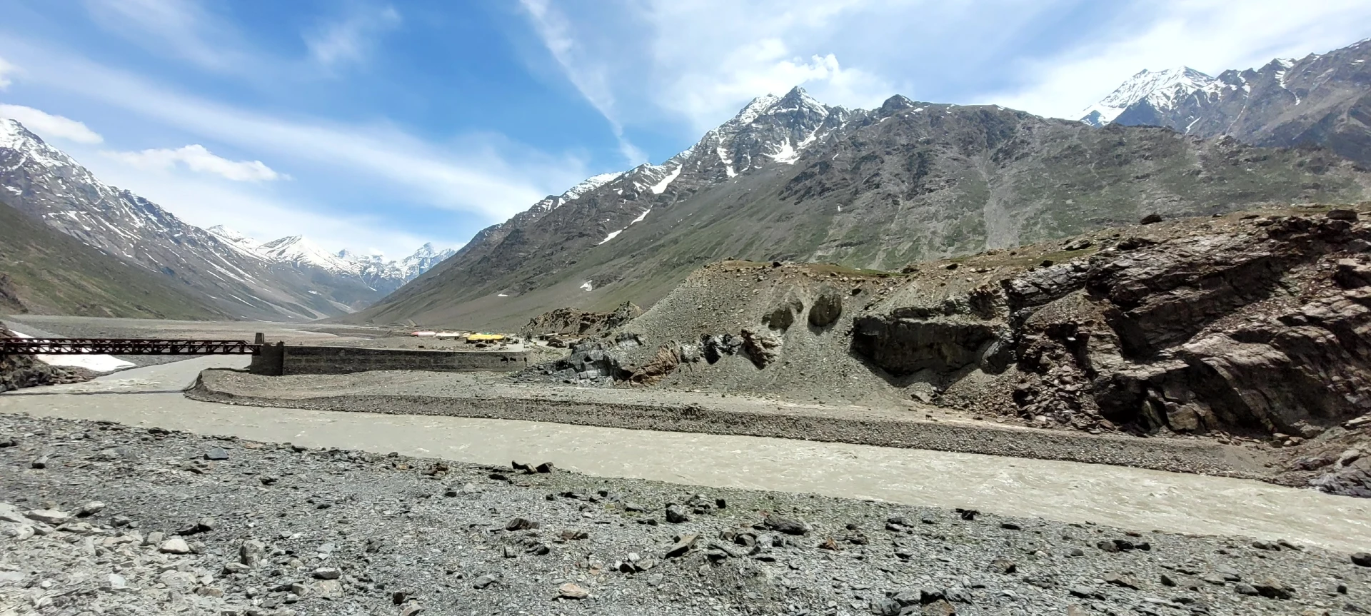
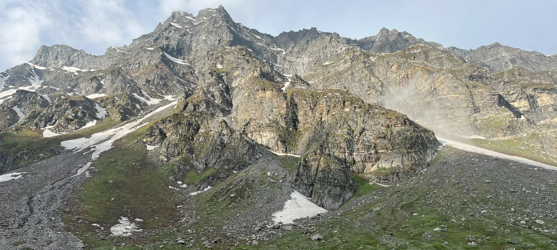
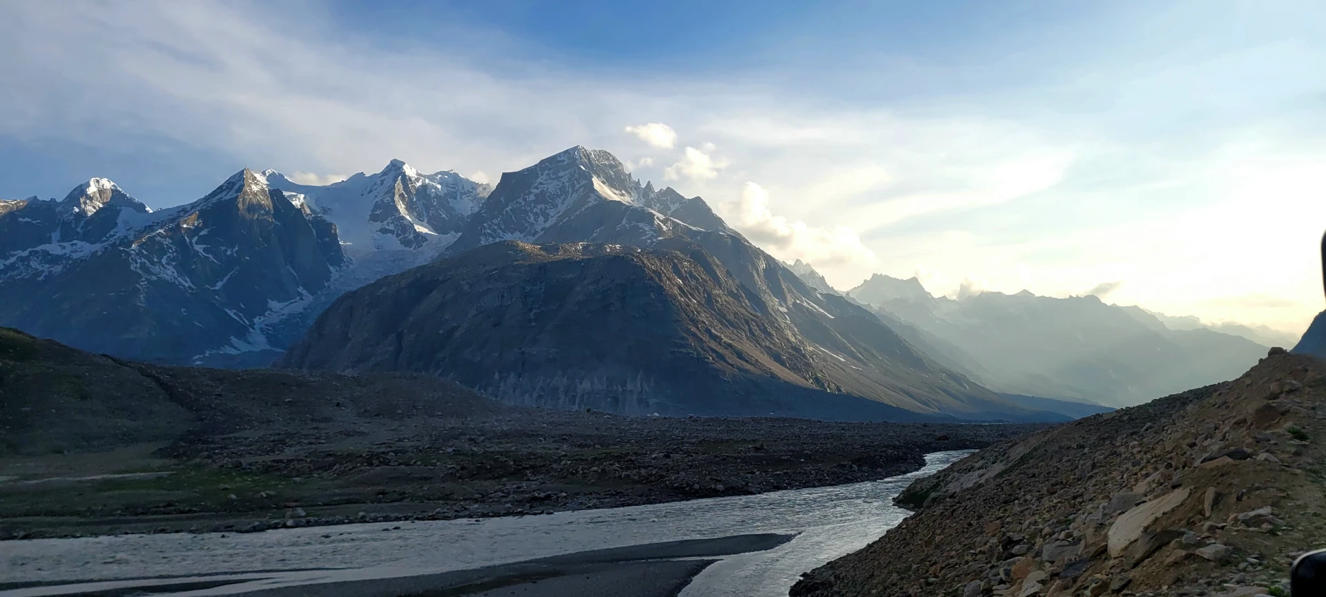
Cancellation Terms
To request a cancellation, please email us at info@walkingthemountains.com using your registered email ID.
Cancellations prior to 28 days from the start of the Trip
Refund Options
- 5% deduction of trek fee
- 100% trek fee cash voucher for any trip until six months from the date of last trek.
- Transfer your trek (any trek, any date) to your friend
Cancellation between 27 days and 15 days to the start of the Trip
Refund Options
- 30% deduction of trek fee
- 100% trek fee cash voucher for same trip till one year
- 85% trek fee cash voucher for any trip till one year
Cancellation between 14 days and 8 days to the start of the Trip
Refund Options
- 50% deduction of trek fee
- 80% trek fee cash voucher for same trip till six months.
- Book the same trek, in the same season, with any other batch
- Transfer your trek (same trek, any date) to your friend
Cancellation less than 7 days to the start of the trek.
Refund Options
- No cash refund
- 20% trek fee cash voucher for the same trip until six months.
Itinerary and Modifications
- WTM reserves the right to modify, shorten, or cancel any part of the Trip due to transportation delays, weather, health emergencies, or other unforeseen circumstances including Force Majeure.
Cancellations and Refunds
- No refunds or vouchers, partial or otherwise, shall be provided for voluntary withdrawal, non-utilisation of services, or removal from the Trip.
- If WTM cancels the Trip before arrival at the designated pick-up point due to unforeseen circumstances or Force Majeure, the Participant may choose from:
- An alternate Trip/date.
- A credit voucher valid for one (1) year.
- Transfer to another Trip, with cost differences payable by the Participant.
- If the Trip is abandoned post-arrival at the designated pick-up point, no cash refund or voucher shall be issued. The Trek Again Policy may apply at WTM’s discretion.
- WTM shall not be liable for any associated travel costs such as flights, accommodation, or visa fees.
Force Majeure
- Events beyond its control including but not limited to earthquakes, landslides, strikes, curfews, war, pandemic, government restrictions, heavy rainfall or snowfall, windstorms, road blockages, trail disruption, or withdrawal of permits, WTM shall not be held liable for any cancellation, delay, or service modification caused by Force Majeure.
FAQ’S
Gaumukh is such a place where legends and nature directly come in contact with each other in the most wonderful manner. It is a snout of the Gangotri Glacier and the source of the sacred River. When you stand in front of it you almost feel that you are experiencing the Himalayas itself beating.
The glacier’s snout resembles the head of a cow, which is why it is called Gaumukh. It is also a very highly spiritual place since Gaumukh forms a great portion of the Char Dham Yatra. Gaumukh is a symbol of purity, devotion, and the eternal charm of the high Himalayas.
Yes, you can if you have a prior trekking experience. However, a local guide is recommended to ensure the safety and route navigation in case of drastic weather change.
Accommodation on the Gaumukh Tapovan trek typically consists of tents. Campgrounds are set up at various points along the route, providing basic shelter and amenities.
The trek is moderate to difficult in difficulty level. It is an 8 day trek, and involves long walking days. But the most beautiful thing about this trek is that every day involves its own beauty. In these 8 days, you will experience the Aarti of Gangotri, flora and fauna of Chirbasa and Bhojwasa, river Bhagirathi and Gaumukh, the high altitude meadow of Tapovan, and mighty peaks such Mt. Meru, Bhagirathi - I, II, III, and the grand Mt. Shivling. It is a 40 km trek that provides all the essence of the Himalayas.
A high level of physical fitness is required for the Gaumukh Tapovan trek. Participants should be in good health and prepared for strenuous physical activity over several days.
No, camping is not allowed directly at Gaumukh snout because it is within a protected area and considered sacred.
Yes, there is a chance of Acute Mountain Sickness (AMS) on the Gaumukh Tapovan trek due to the high altitude. We make sure to acclimatize properly and follow a gradual altitude gain to reduce the chances of AMS. As a responsible trekker, you can educate yourself about the signs and symptoms of AMS and immediately report to your Trek Leader if you notice any such signs.
The best time for trekking to Guamuk Tapovan trek is from May to June and September to October. These are summer and post monsoon windows that are considered the best time for this trek, and offer the safest and most pleasant trekking experience.
Here’s what each season offers:
May to June: You will get the fresh view after winter snow and the early bloom of high altitude flowers. During this time, the glacier is also more accessible.
September to October: After monsoon the dust is washed away, and the landscape becomes green and clean. After the monsoon, you will also get to see the best views of the peaks, and landscape.
Avoid the trek during:
July to August: This period is monsoon time. Heavy rainfall can cause landslides, so avoid trekking to Guamukh during monsoon.
Late October onwards: Snowfall begins, and the trail closes for the winter due to freezing temperatures and glacier inaccessibility.