
Hampta Pass Trek

Region
Himachal Pradesh

Duration
5 days

Max. Altitude
14100 ft.

Trek Distance
24 kms

Grade
Easy to Moderate
Fixed Departures
October -2026
- 6 Oct - 10 Oct
- closed
June - 2027
- 4 June - 8 June
- Open
- 10 June - 14 June
- Open
- 16 June - 20 June
- Open
- 22 June - 26 June
- Open
July - 2027
- 3 July - 7 July
- Open
- 9 July - 13 July
- Open
- 15 July - 19 July
- Open
- 21 July - 25 July
- Open
₹12,700
+5% GST / Person
Highlights
- Services: Jobra to Chattru
- Pickup Location : Private Bus stand, Manali
- Drop Location : Manali Bus Stand
- Pickup : 10:00 AM | Drop : 6:30–7:30 PM (weather/road dependent) Keep a buffer day and arrive a day early to avoid delays.
Add-ons
- Transport
- Rs. 2700/- Per Person
- Offload
- Rs 2000/- Per person
Add on information
- Insurance is mandatory.
- It is available for Indian citizens only.
- Non-Indians have to take insurance on their own.
- The cancellation policy will be implemented in accordance with the trek cancellation policy.
- Backpack offload is optional.
- Choose add-ons during booking. If missed, you can contact us to book the same.
- Book off-load at least 10 days before the trek.
- For offline bookings at the base camp, a variable convenience fee may apply. (It differs from trek to trek)
- Offload can't weigh more than 10kg. Offload should have a waterproof cover. Suitcases/trolleys will not be allowed.
- In the event that you choose to cancel your trek prior to the departure date, you will receive a full refund.
- Note : The bag weight should not exceed 10 kg.
- Transportation: Manali to Jobra and Chattru to Chandrataal and Manali return is optional.
- Choose add-ons during booking. If missed, you can contact us to book the same.
- Book transportation at least 10 days before the trek.
- Cancellation 6 or more days before the start of the trip results in a 100% cash refund.
- Cancellation less than 4 days from the start of the trip results in a 50% cash refund.
- Cancellations made on the trip date are not eligible for a refund.
Hampta Pass Trek Overview
- Trek Name : Hampta Pass Trek
- Days : 5
- Adventure : Trekking
- Base Camp : Manali
- Season : Monsoon | Autumn
- Months : June | July | August | September
- Country : India
- Altitude : 14100 ft
- Grade : Easy to Moderate
- Trail Type : Cross over trail | Start in one valley, traverse the pass, and ends in another valley.
- Food : Meals while on trek (Veg + Egg)
- Location : Himachal Pradesh
- Distance : 24 km
- Rail Head : Chandigarh is the nearest rail head to the base camp
- Stay : Camping (Twin sharing)
- Airport: Bhuntar, which is 52 km away from Manali
Why is Hampta Pass a Must- Do Trek?
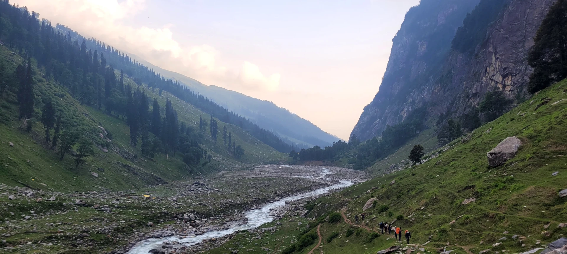
- Hampta Pass is a high-altitude crossover trek that connects the lush green Kullu Valley to the stark, arid landscapes of the Lahaul region.
- The dramatic shift in scenery during this trek is nothing short of stunning, with every day bringing a new backdrop.
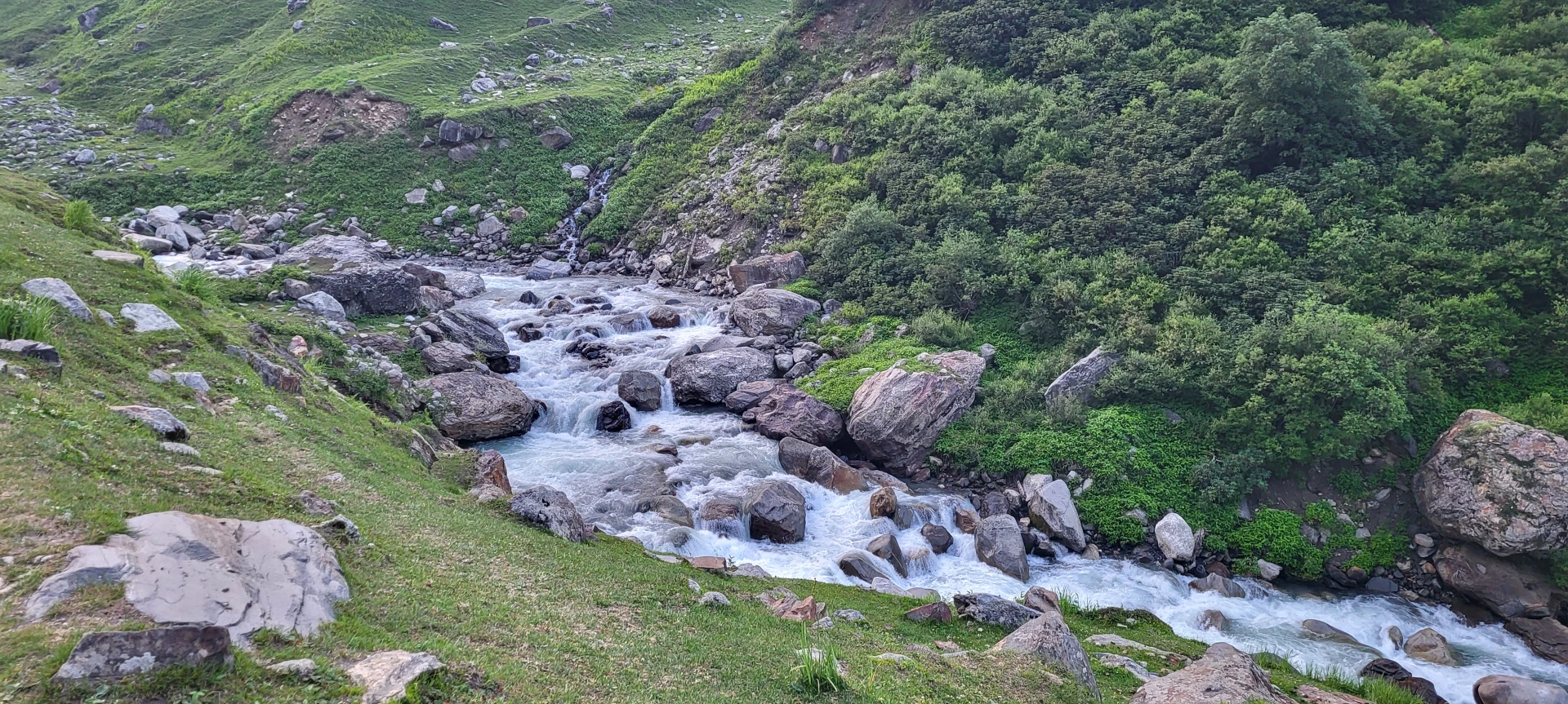
- Stream crossings add a thrill to the adventure, especially as you wade through icy, gushing waters using ropes for support.
- Standing at over 14,000 ft, the view from Hampta Pass showcases towering peaks and dramatic valleys.
- The close-up views of Mt. Indrasan and Mt. Deo Tibba are a visual treat for mountain lovers and photography enthusiasts alike.
- Each campsite like Shea Goru, Chhika, and Balu Ka Ghera, is scenically placed, surrounded by mountains and streams.
- The trek offers a moderate challenge, making it ideal for beginners with good preparation who want to experience a high-altitude pass without extreme difficulty.
- A major highlight of Hampta Pass trek is the visit to the stunning Chandratal Lake, a crescent-shaped alpine lake with unreal blue hues.
- During the summer and monsoon months, the valley blooms with vibrant wildflowers and diverse wildlife.
Major Attractions of the Hampta Pass Trek
- Hampta Pass : The most significant part of the trek, the Hampta Pass crossing is an adventure in itself. Being at a high altitude it tests your endurance and strength, but the surrounding views make up for it. The pass itself is a wide passage that goes on for some time, once you are at the pass you get closest to the Deotibba and Indrasan peak.
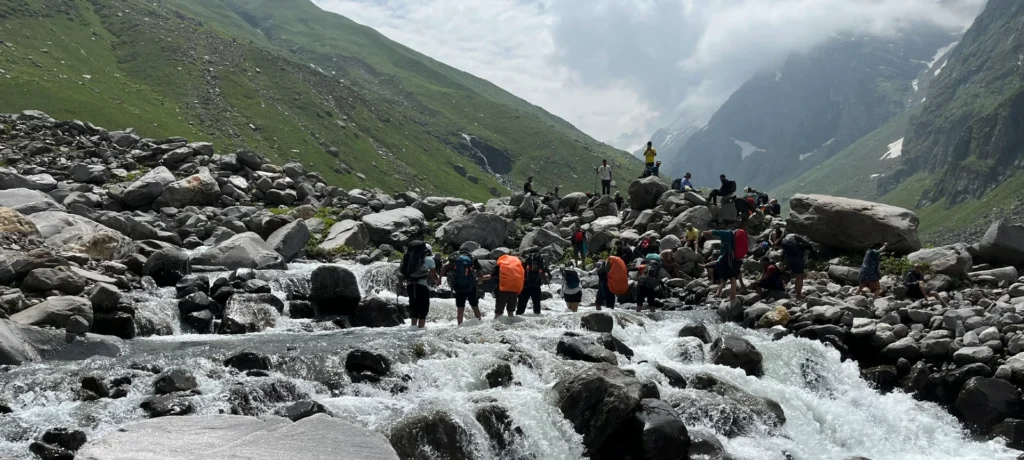
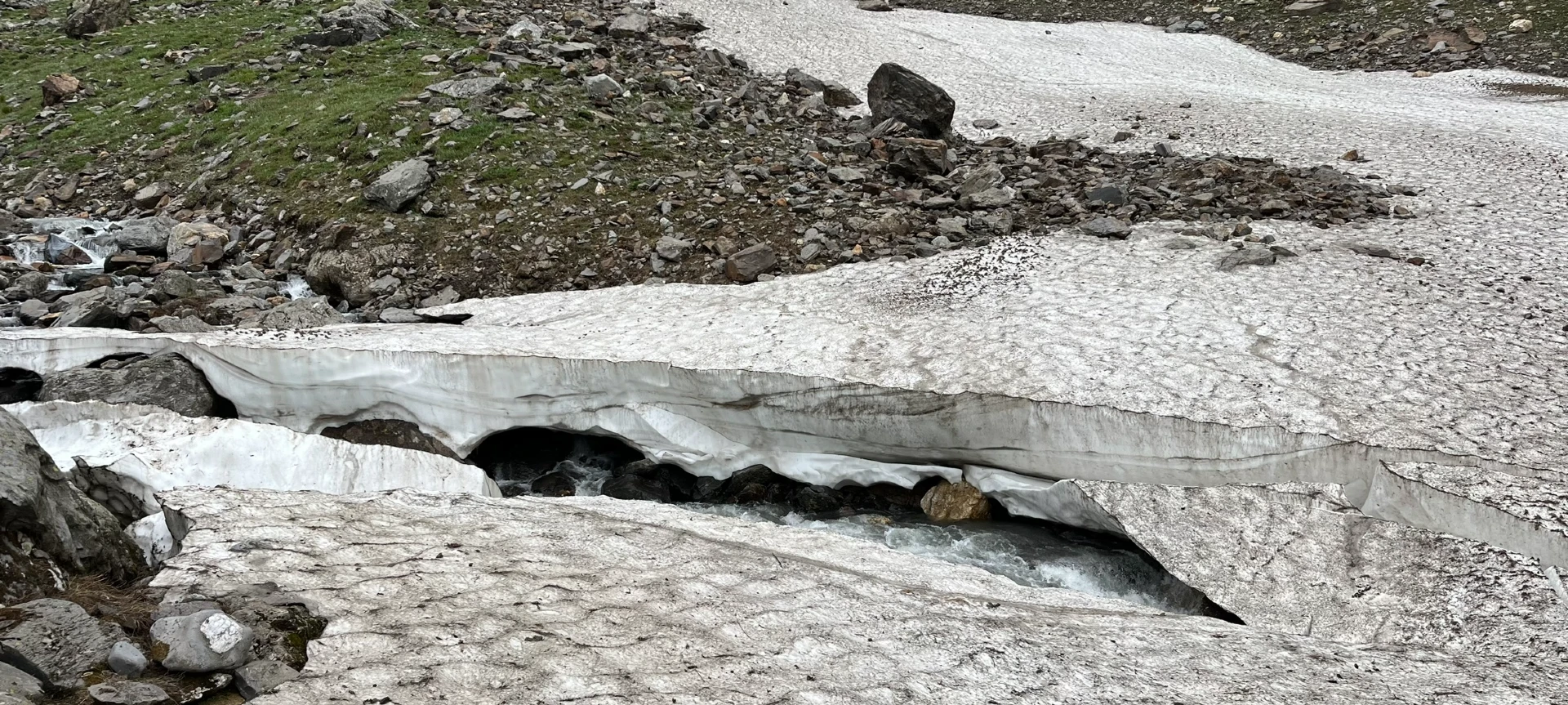
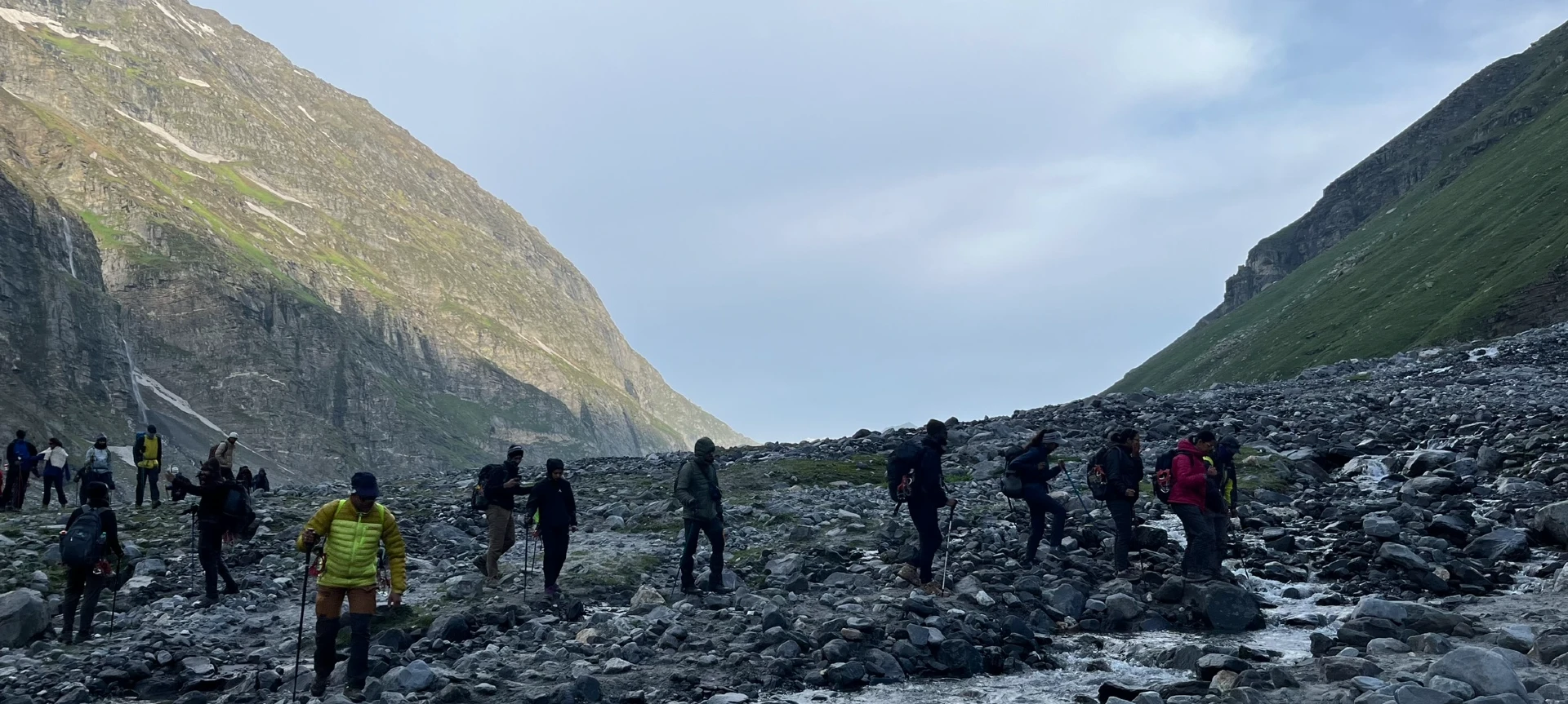
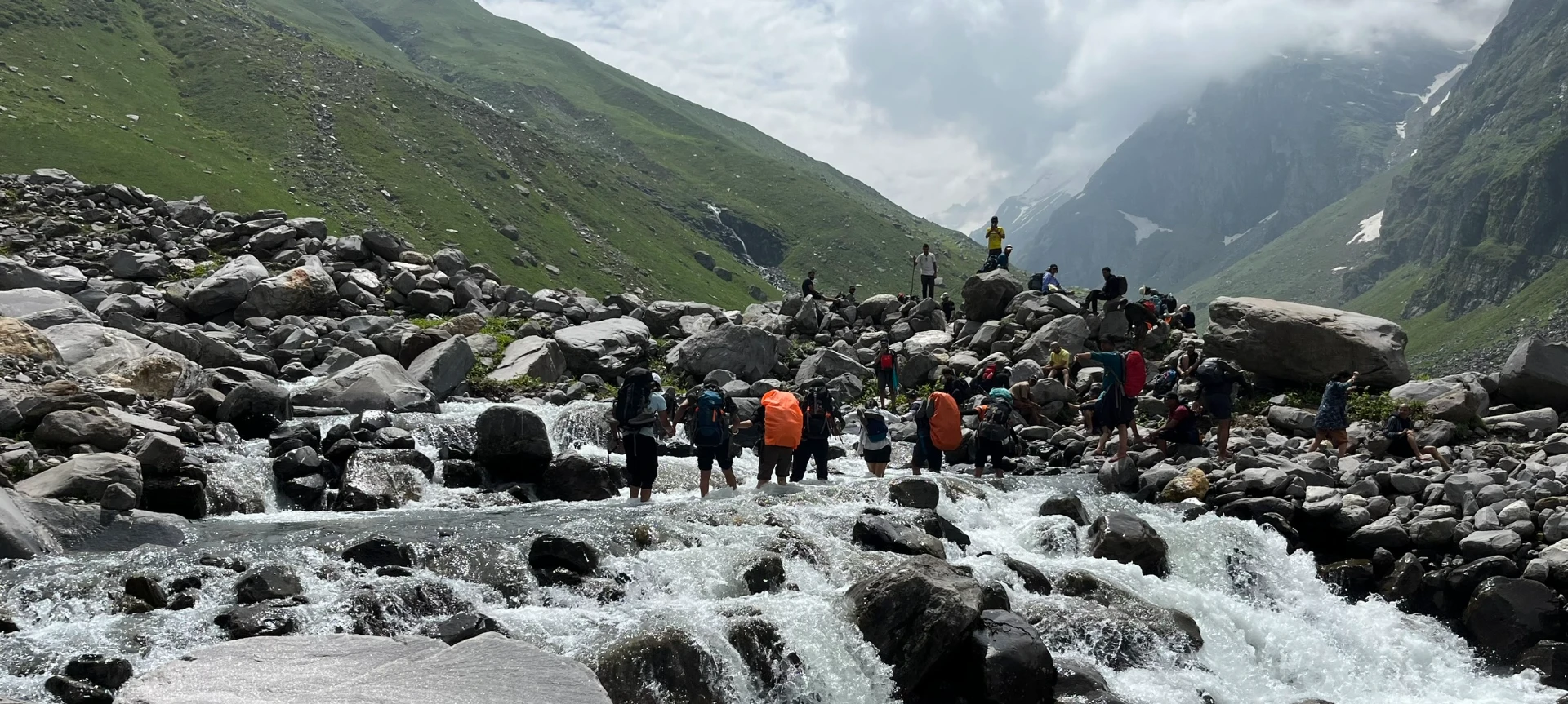
- River Crossings : The trek is full of exciting moments, and crossing rivers with the help of ropes is one of the most adventurous parts. You’ll cross fast-flowing mountain streams and icy rivers at two points, once while trekking from Chika to Balu Ka Ghera, and again from Shea Goru to Chatru. These rope crossings not only give a thrilling experience but also bring out teamwork and courage, making them some of the most memorable highlights of the trek.
- Scenic campsites : Another beautiful aspect of the Hampta Pass Trekking experience is the chance to camp at some truly magical spots. From the open green meadows of Chika, where you fall asleep to the sound of a flowing river, to Balu ka Gera, surrounded by snow-draped peaks, and the remote setting of Shea Goru, each campsite feels like a beautiful resting spot.
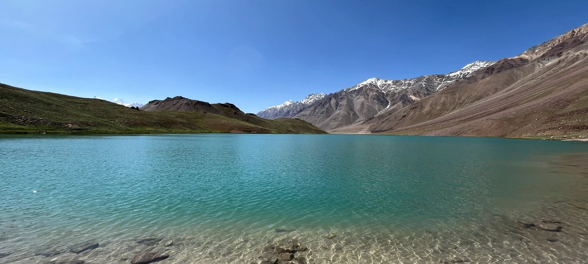
- Chandratal : An additional beauty to the trek, Chandratal Lake is a serene glacial lake located in the Spiti region. The name means “Moon Lake,” and true to its name, it has a quiet, otherworldly charm. Surrounded by mountains and set against the wide blue sky, the lake’s crystal-clear waters reflect the changing colors of the sky throughout the day. Reaching Chandratal at the end of the trek feels like a dream, and spending time here is peaceful and calming.
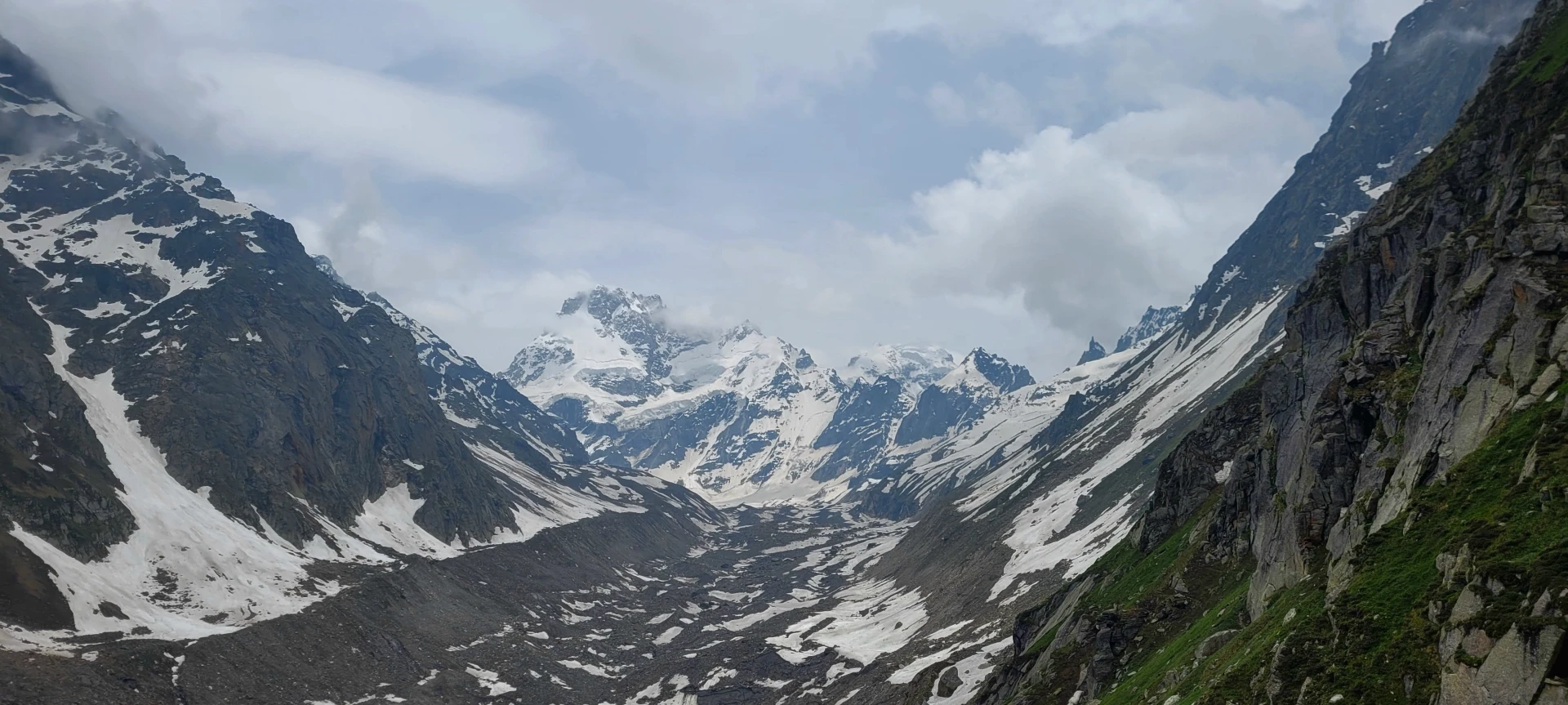
- Mountain Views : The Hampta Pass trek offers some of the best panoramic views of the Himalayas. From snow-covered peaks to deep valleys and glacier fields, the scenery constantly evolves. On clear days, you can spot peaks like Indrasan, Deo Tibba, and their glaciers. These views not only offer great photo opportunities but also a deep sense of connection to the majestic scale of the mountains around you.
- The change in Terrains: Hampta Pass Trek takes you through a variety of terrains. The journey begins in dense forests,moves into wide green meadows, and gradually leads to rocky trails, snowy slopes, and barren deserts of Spiti. This continuous change keeps the trek exciting and refreshing. It’s like walking through different worlds within a few days.
Hampta Pass Trek – A Journey Through Two Worlds
The Hampta Pass trek is one of the most dramatic and equally breathtaking treks in India. It is also called a “crossover path” because it connects two entirely different Himalayan landscapes in a single trip. It offers a visually captivating transition from lush green Kullu Valley into the barren, moon-like landscapes of Lahaul Valley. One moment you are walking through dense forests, mesmerizing waterfalls, and flower-laden meadows, and the next you are surrounded by rocky mountains and cold desert terrain.
Hampta Pass is the perfect balance of adventure, beauty, and accessibility for beginners as well as experienced trekkers. This striking contrast makes it truly special, which is why the route remains visually rich throughout the journey. The biggest attraction of the trek is crossing the Pass itself. Standing at the top provides you with incredible views of snow-covered Himalayan peaks and deep valleys. The sense of accomplishment at the pass is unforgettable.
This trek is also famous for its scenic campsites, which are surrounded by steep mountains, glacial rivers, and open meadows. You have to cross the freezing waters of different streams a couple of times, which adds an exciting adventure to the journey. Finally, the excursion to the Chandratal Lake is the icing on the cake. This lake is famous for its crystal-clear blue water and stunning mountain reflections.
Eligiblity for Hampta Pass Trek
- Age Requirement : Minimum 12 years
- First-timers are welcome, though prior trekking experience is preferred. Good fitness is a must.
- Fitness Criteria :
- The Trekker should have sufficient stamina to cover 5 km of distance by jogging in 33 minutes without stress or 10 km of distance in 75 minutes without stress
- If the trekker prefers cycling he/she should be able to cycle 15 km of distance in 45 minutes.
- If the trekker wants to carry a backpack then he/she should be able to carry a 10-12 kg backpack. If opt Off-load option then the trekker should be able to carry 3-5 kg backpack.
- If a trekker's BMI is more or less than the normal range (18-28), please consult our Trek Coordinator before booking.
Hampta Pass Trek Itinerary
01. Drive from Manali to Jobra and Trek from Jobra to Chhika
- Altitude :
- Manali - 2,050 m / 6,730 ft
- Jobra - 2,800 m / 9,300 ft
- Chhika- 3,100 m / 10,100 ft.
- Drive Distance (Manli to Jobra) : 16km | Duration: 1hr.
- Trek Distance (Jobra to Chhika) : 3km | Duration: 2hrs.
- Altitude Gain : 3,370 ft.
Note: Reporting Time: 10:00 AM, Place: Private Bus Stand Manali, Drop Time: 6:30 pm to 7:30 pm (Timings are subject to change based on weather and road conditions). Today’s lunch will be borne by the participants.
02. Trek from Chhika to Balu Ka Ghera
- Altitude (Balu Ka Ghera) : 3,600 m / 12,000 ft.
- Trek Distance : 7km | Duration: 5-6 hrs.
- Altitude Gain : 1,900 ft.
03. Trek from Balu Ka Ghera to Shea Goru via Hampta Pass
- Altitude :
- Hampta Pass - 4,300 m / 14,100 ft
- Shea Goru- 3,900 m/ 12,900 ft
- Trek Distance : 7-8 km | Duration: 9 - 10 hrs
- Altitude Gain : 2,100 ft; Then loss of 1,200 ft
04. Trek from Shea Goru to Chatru and Drive to Chandratal
- Altitude :
- Chatru- 3,350 m / 11,000 ft.
- Chandratal - 4,300 m / 14,100 ft
- Trek Distance : 7 km | Duration: 4-5 hr.
- Drive Distance : 70 km | Duration: 4-5 hrs to
- Altitude gain of 1,200 ft and then loss of 3,100 ft.
Note: The drive to Chandratal and back to the campsite will be done either on day 4 or day 5, depending on road and weather conditions.
05. Drive from Chatru to Manali
- Altitude (Manali) : 2,050 m / 6,730 ft
- Drive Distance : 65 km | Duration: 4-5 hr.
- Altitude Loss : 4,270 ft.
Note:
- Keep a buffer day in your travel plan.
- If buffer day is not used in the travel then it can be used to Explore Manali.
- Distance, Altitude, and Trekking hours are approximate and rounded off.
- Keep the original and copy of ID proof handy.
- Come one day early if planning to come by flight.
Drive from Manali to Jobra and Trek from Jobra to Chhika
- Altitude :
- Manali: 2,100 m / 6,400 ft
- Jobra: 2,800 m / 9,300 ft
- Chhika: 3,100 m / 10,100 ft
- Altitude Gain: 3700 ft
- Drive Distance (Manali to Jobra) : 16km | Duration: 1hr
- Trek Distance (Jobra to Chhika) : 3km | Duration: 2hrs
The Hampta Pass trek begins with a scenic drive from Manali to Jobra, a beautiful trailhead situated at an altitude of approximately 9,300 feet. The drive distance is around 16 km, which usually takes about 1 to 1.5 hrs, and follows winding mountain roads. Dense forests of pine, maple, deodar, and silver oak mostly dominate the route. This lush vegetation offers a stunning glimpse into the rich Himalayan ecosystem.
One of the unique attributes of this drive to Jobra is the breathtaking “42 curves”, which offer an astounding bird’s-eye view of the Kullu Valley. As you gain altitude, the air becomes thinner, cooler, and perceptively fresher. Kullu Valley. As you gain altitude, the air becomes thinner, cooler, and perceptively fresher.
After reaching Jobra, the actual trek begins; it is roughly 3 km and takes around 2 hours at a comfortable pace. The starting point of the trek is the Allain Duhangan Hydropower Plant that lies just by the main roadhead. The climb is short and gradual, but more importantly, it serves as an effective acclimatization walk. Twenty minutes into the trek, and you will arrive at the bend that overlooks a lush meadow.
After passing through the meadow for a while, the Rani Nallah comes into view, which flows right through the middle. Chhika campsite, situated at around 10,100 feet, lies beside the Rani Nallah stream. The evening atmosphere is serene, with mist drifting through the valley and temperatures dropping significantly after sunset.
Thus, geographically, Day 1 introduces you to the green Kullu Valley landscape characterized by forests, river-fed meadows, and moderate Himalayan terrain.
Trek from Chhika to Balu Ka Ghera
- Altitude (Balu Ka Ghera) : 3,600 / 12,000 ft
- Trek Distance : 7km | Duration: 5-6 hrs
- Altitude Gain : 1900 ft
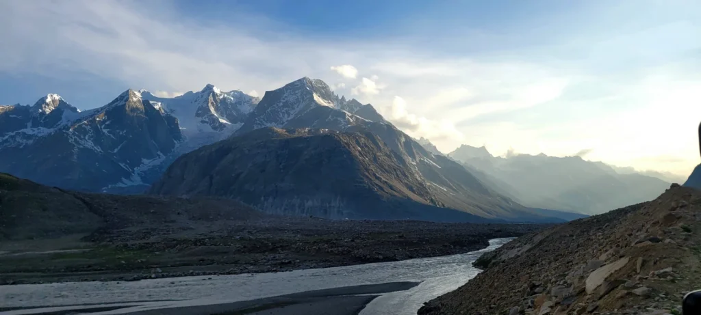
Day 2 marks the transition from forested valleys into the more rugged high-altitude landscapes of the Himalayas. The trek from Chhika to Balu Ka Ghera is approximately 7 kilometers and generally takes 5 to 7 hours, depending on weather conditions and the group’s pace.
Starting from an altitude of around 10,100 feet, you have to gradually ascend to nearly 11,900 feet by the time you reach the campsite. From the direction of the trail, you can guess that the campsite falls on the right-hand side.
The entire stretch of the river’s right bank is lined with amazing dwarf rhododendron trees. These trees will cover the lower and the central regions, and a cluster of silver birch trees covers the upper region.
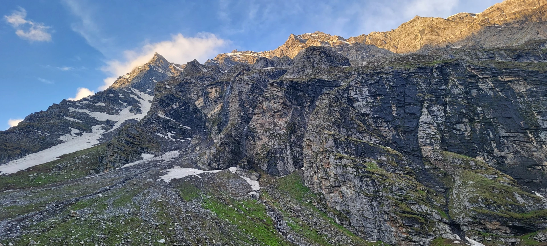
Right at this point, behind you is a breathtaking panorama of the snow-covered Dhauladhar range. A short distance ahead, you’ll spot a clear stream and waterfall on the left—the perfect place to refill your water bottles.
Actually, the entire trek is all about hopping across streams with several cascading waterfalls, especially in monsoons.
As you walk past the waterfall, the trail progresses along the left side of the river. So, to get to the other side, you’ll need to wade through the icy stream, so be prepared to get your feet wet. The water is biting cold, which stings like a bee. Make sure to carefully jump upon the rocks that are scattered across the stream.
By the time you reach Jwara, you will have completed nearly half of the day’s trek. Jwara is a beautiful valley that is surrounded by snow-laden cliffs on one side and gentle slopes on the other. The serene beauty of this place is complemented by the melting snow being fed into the river. You can also witness cattle peacefully grazing across the meadows.
Ahead of this U-shaped valley leading to Balu Ka Ghera, you’ll see snow-clad peaks rise dramatically. The trail winds along the riverside, and this stretch is stunningly adorned with a vibrant array of wildflowers.
The last traces of the tree line fade behind you. It takes roughly half an hour to reach the far end of the valley, marking the final stretch of Jwara. Beyond this point, the trail transitions into a snowy and rocky slope.
Before approaching Balu Ka Ghera, the path levels, but it’s composed of rocks and boulders. The term “Balu Ka Ghera” translates roughly to “bed of sand,” accurately describing the geography of the campsite. Located in a wide river basin surrounded by barren mountains, the area consists largely of sandy and rocky terrain deposited over centuries by glacial activity.
Trek from Balu Ka Ghera to Shea Goru via Hampta Pass
- Altitude :
- Hampta Pass: 4,300 m / 14,100 ft
- Shea Goru: 3,900 m / 12,900 ft
- Trek Distance : 7-8 km | Duration: 9 - 10 hrs
- Altitude Gain : 1,200 ft and then loss of 3,100 ft
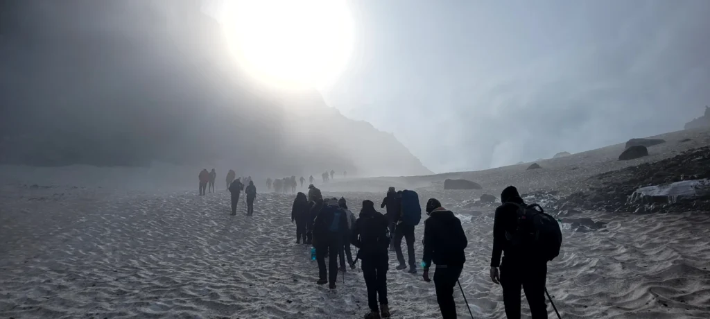
Today’s trek is probably the most demanding as well as the rewarding one. Covering approximately 7 to 8 kilometers over 9 to 10 hours, the day involves crossing the holy grail of this journey, Hampta Pass (14,100 ft), and then descending into the stark landscape of the Lahaul region. The trek starts by heading towards the mountains you witnessed the moment you entered the valley. The views from Balu Ka Ghera are unmistakably stunning, as you can see a clear transformation from lush meadows to rocky moraine sections.
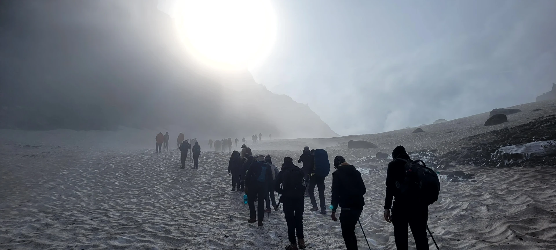
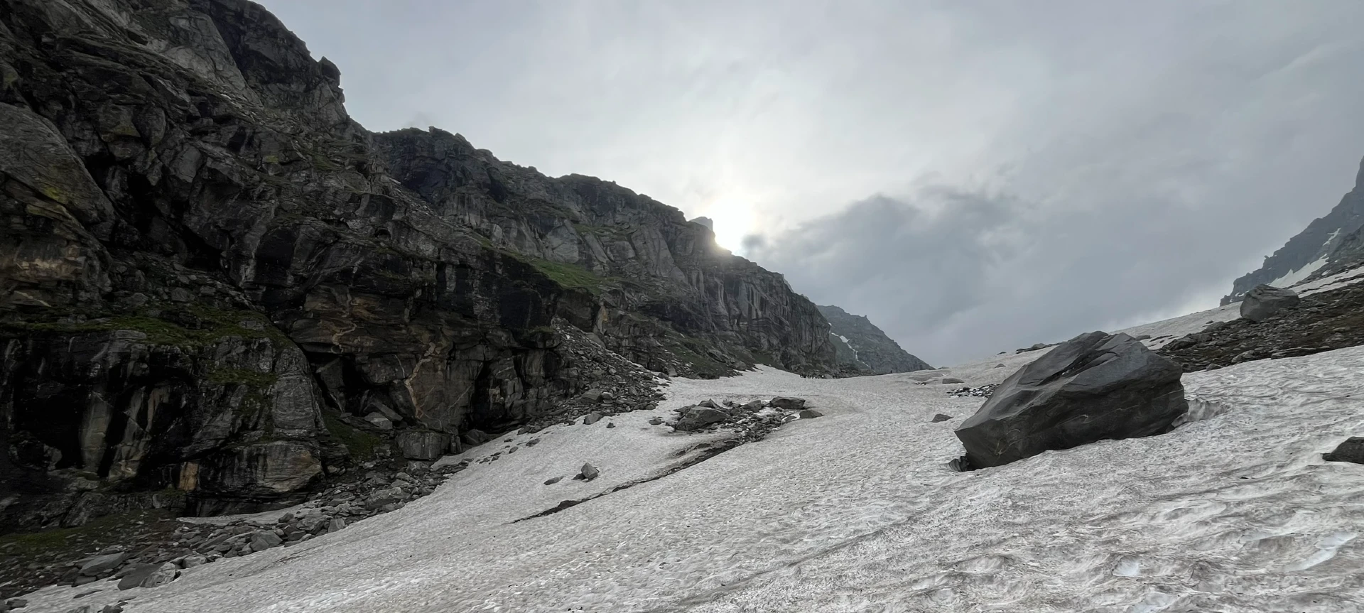
The trail runs along a river that takes you to the base of Hampta Pass. After an hour of trek from here, you’ll reach the first plateau, which is completely covered by snow in winter. After some time, you reach another plateau and then a ridge. Then, from the first ridge, trek further up to the second ridge. Hampta Pass is just a few meters and a bend away from the second ridge.
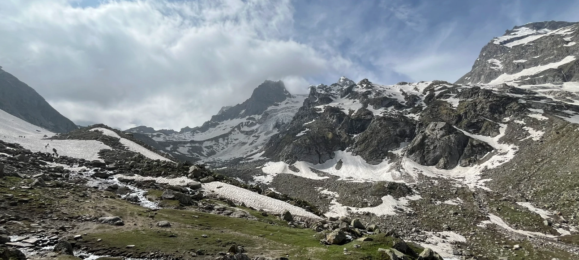
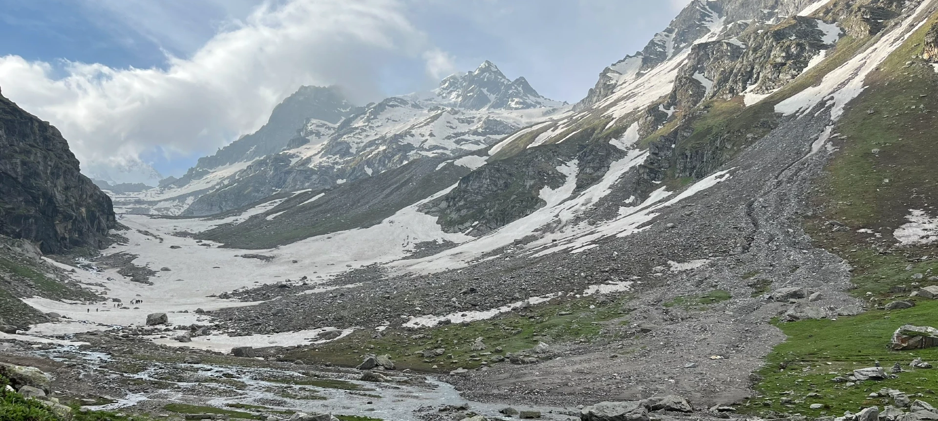
Reaching Hampta Pass offers breathtaking panoramic views of two different regions simultaneously the lush-green Kullu Valley on one side, and the barren, cold terrain of the Lahaul region. One of the striking features you witness here is the Hampta glacier hanging from a mountain. You can also see the Indrasen Peak from here. As you cross the pass and start descending, Shea Goru looks absolutely incredible from a bird’s-eye view. Gradually, the route enters the Lahaul valley region, known for its dry, rocky, and sparsely vegetated geography. At an altitude of 12,900 feet, Shea Goru is a picture-perfect glacial valley with a glacial stream cutting right through it.
The terrain on this day showcases one of the most remarkable geographical transitions in the Himalayas. Within a single day, you witness multiple terrains – green ecosystems, rocky cliffs, glacier-fed rivers, moraine deposits, and snow-covered slopes.
Trek from Shea Goru to Chatru and Drive to Chandratal
- Altitude :
- Chatru: 3,350 m / 11,000 ft
- Chandratal: 4,300 m / 14,100 ft
- Trek Distance : 7 km | Duration: 4-5 hrs
- Altitude Gain : 70 km | Duration: 4-5 hrs
- Altitude Loss : 4,270 ft.
Day 4 offers a comparatively easier trekking experience but introduces you to some of the most dramatic cold-desert scenery in Himachal Pradesh. The trek from Shea Goru to Chatru covers around 7 kilometers and usually takes 4 to 5 hours. From Chatru, you will drive to the famous Chandratal Lake, depending on road and weather conditions.
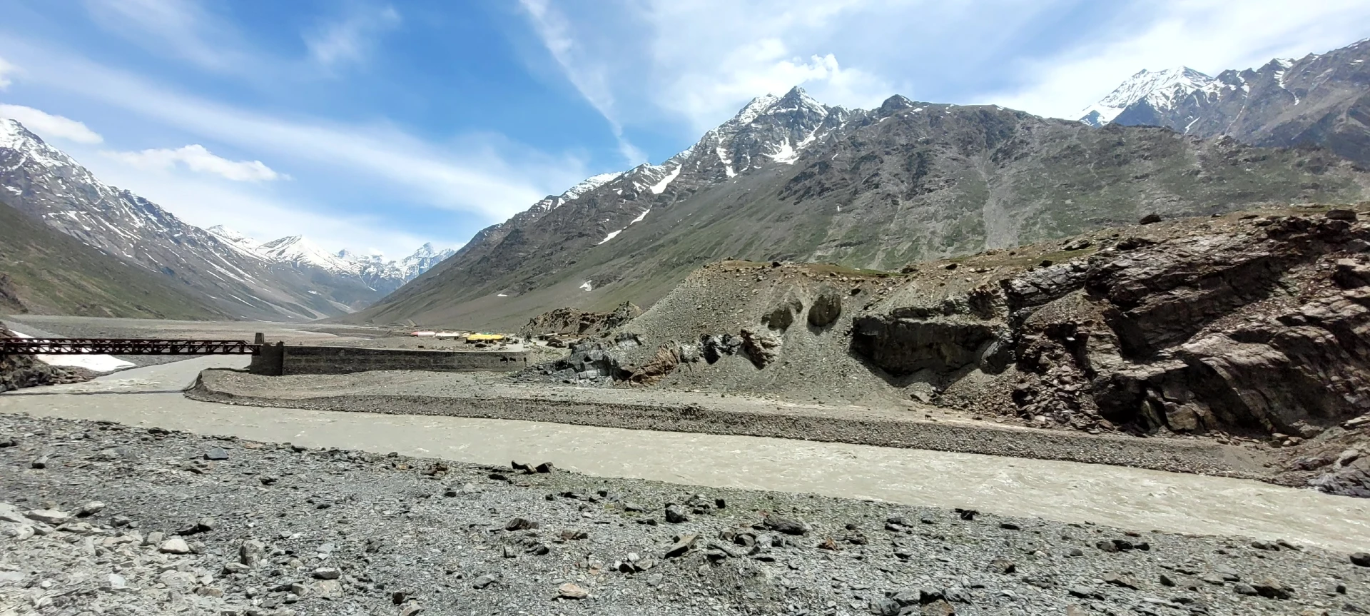
The trail descends steadily along the Chandra River basin through rocky and barren terrain. Unlike the green valleys seen earlier in the trek, this region belongs to the rain-shadow zone of the Himalayas. Vegetation is minimal, and the mountains display shades of brown, grey, and rust due to exposed rock formations and sparse plant life. The geography here is shaped largely by glacial erosion and extreme climatic conditions. Water sources remain available throughout the trek, although the water is icy cold due to direct snowmelt. One of the main attributes of this day is the continuous presence of glacial streams flowing into the Chandra River.
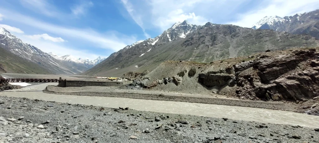
As you approach Chatru, the valley opens up and reveals sweeping views of barren Himalayan landscapes intersected by winding rivers. Chatru itself is a small seasonal settlement located at approximately 11,000 feet and acts as an important junction connecting routes toward Spiti, Rohtang, and Lahaul. There is also a unique landmark near Chatru – a mighty stone bridge that appears to have been built hundreds of years ago.
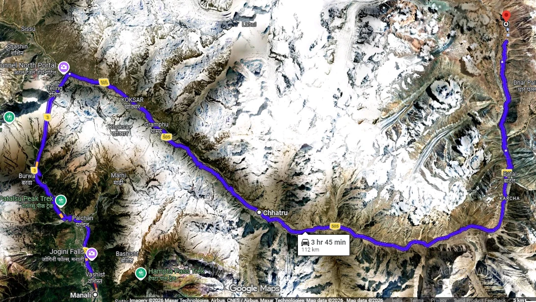
The drive to Chandratal is an adventure in itself. The route is uneven and rough and goes through high-altitude terrain with sharp cliffs, river crossings, and glacial valleys. Located at around 14,100 feet, Chandratal Lake — meaning “Moon Lake” – is famous for its crescent shape and crystal-clear blue waters.
The night by the Chandratal Lake offers exceptional stargazing opportunities due to minimal light pollution and extremely clear mountain skies.
Drive from Chatru to Manali
- Altitude (Manali) : 2,050 m / 6,730 feet
- Drive Distance : 65 km | Duration: 4-5 hrs
- Altitude Loss : 3770 ft
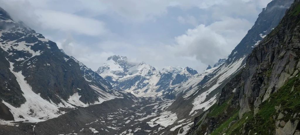
The last day of the Hampta Pass trek involves a visually spectacular drive from Chatru back to Manali. It’s a 65 km journey that usually takes 5 to 6 hours, depending on road conditions and weather. The drive is essentially a memorable conclusion to the expedition through some of the most varied Himalayan landscapes.
The landscape remains rugged and dry, which is a characteristic of the cold desert geography of a typical trans-Himalayan region. Roads are rough and narrow with sharp bends that appear like being carved into steep mountain faces. To some extent, the drive is as adventurous as scenic.
One unique aspect of this day is the opportunity to witness the trek’s full geographical diversity in reverse order. You are basically moving from high-altitude deserts through mountain passes and eventually into lush Himalayan valleys in a single drive. More importantly, it offers ample opportunities for photography and reflection on the journey completed over the previous days.
Note: The visit to Chandratal Lake will be either on Day 4 or Day 5, which is 70 km from the Chatru campsite. We can visit Chandratal only if the road and weather conditions permit it. If not, we will have to drive directly from Chatru to Manali and skip Chandratal altogether.
Health and Awareness
- Pulse rate at rest must be in between (60 to 100 beats per minute).
- Blood Pressure Reading must be in between (DIASTOLIC 75 – 85, SYSTOLIC 100 - 130 mm Hg).
- Respiratory rate at rest must be in between (12 to 20 breaths per minute).
- Should not have Liver and kidney issues.
- Should not have Diabetes Mellitus, Bronchial Asthma, Heart problems, Hypertension, etc.
- No pacemaker implant.
- People with Sinus issues, Epilepsy please contact to trek coordinator before booking the trek.
Important Links
If your BMI is not normal, Please contact our Trek coordinator before Trek booking.
Medical & Disclaimer Form (Mandatory Documents) Click here to download Medical & Disclaimer Form
How to Reach:
Pickup Information
- If you choose WTM’s pickup service, WTM will manage the rest of your travel arrangements once you have reached the assembly point of the trek in Manali. You can select this option during the booking process by adding it as an add-on.
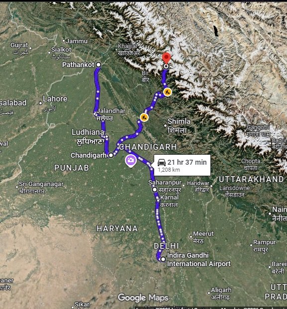
- To reach Hampta Pass, you have to first travel to Manali, which is the main base camp. Before that, you can arrive at Chandigarh, Delhi, Pathankot, or Bhuntar airport.
- Please Note : The most ideal place to reach Manali is from Chandigarh.
Arrival by Bus
If you are taking a bus for Manali, then try to take the bus from Chandigarh, as it’s more convenient.
- To take the bus from Chandigarh, first reach the Inter-State Bus Terminus (ISBT) in Sector 43. From there you can take a direct overnight bus to Manali, which will take approx. 6 - 10 hours to reach.
- According to the HRTC schedule, the first bus for Manali departs at 3:40 AM and the last one runs until 9:00 PM. Although, we highly recommend that you visit the HRTC website to check the bus schedule according to your travel plan.
- From Delhi, reach the ISBT Kashmiri Gate and take a direct bus to Manali, which takes around 14 hours to reach. A pro tip: numerous buses leave for Manali throughout the day, but departures peak between 6:00 PM and 11:55 PM.
(We highly recommend choosing government buses over private ones; based on our experience, private buses are more prone to delays.) Government buses are generally more reliable. Whichever option you choose, ensure you reach Manali by 10:00 AM on the pickup day.
Arrival by Air
For all the international trekkers opting for flight, it is the most preferred option to reach Bhuntar Airport (Kullu-Manali Airport).
| Location | Travelling Guide/Travel Instruction |
|---|---|
| DELHI |
The Indira Gandhi International Airport, Delhi, is the prime airport that offers a direct flight to Bhuntar Airport.
As for the airlines, the major airline that offers a direct flight to Manali is the “Alliance Air”. Other than that Air India, IndiGo, and others also operate on this route. From Delhi Airport, you can also opt to travel by bus as mentioned above. |
| CHANDIGARH |
Since Chandigarh is a better option and it takes less time from here then you can book a connecting flight to Chandigarh via Delhi/Hyd/Pune/Mumbai and then book a cab or take a bus to reach Manali.
The distance between the Chandigarh Airport and Chandigarh Bus Stand is 14 km. |
After arriving at the Bhuntar Airport (Kullu-Manali Airport), you can either take a bus or book a cab to reach the pickup point (Woodbine Hotel).
Note— The flights to Bhuntar are highly dependent on the weather conditions and seasonality. So, we firmly advise you to arrive a day or two before your trek.
Arrival By Train
There is no railway station in Manali, so there’s no direct train that goes there. The nearest major railway stations are: Joginder Nagar (145 – 160 km), Chandigarh (260 – 270 km), Ambala Cantt (320 – 330 km), and Pathankot (390 – 400 km).
From a connectivity point of view, Chandigarh railway station is ideal for reaching Manali. To know more about the train schedule, you can visit the IRCTC website. From Chandigarh Railway Station you need to travel to ISBT Sector 43 (approximately 10–11 km), and then you can take an overnight bus to Manali.
Note: If you prefer to travel on your own, you can choose between a government bus or a private cab. Your trek coordinator will assist you with all the necessary details and guidance for arranging the bus or cab booking.
Drop-Off Information:
- The designated drop-off point is the Manali Old Gov bus stand around 6:30 pm to 7:30 pm.
- Please consider planning your subsequent travel arrangements after 8:00 pm.
- It's highly advisable to keep a buffer day in your travel plan. If the buffer day is not needed, it can be used to explore Manali.
- WTM offers comfortable transportation through Tempo Traveler, Bolero, or equivalent vehicles. If you wish to upgrade your mode of transportation, please contact your trek coordinator for further assistance.
Hampta Pass Trek Cost Terms – Inclusions & Exclusions
1. Accommodation (as per the itinerary)
- Camping on Day 1 to Day 4.
2. Meals (Veg + Egg)
- From the Day 1st Lunch to the Day 5th Breakfast.
3. Support
- 1 Versatile base camp manager: handles communication and deploys extra manpower in emergencies.
- 1 Mountaineering & First aid qualified professional trek Leader.
- 1 Experienced high-altitude chef.
- Local experienced guides (Number of guides depending on the group size).
- Enough support staff.
4. Trek Equipment
- Sleeping bag, Sleeping liners (if required), mattresses, and Utensils.
- 3 men all season trekker tent (twin sharing), Kitchen & Dining tent, Toilet tent.
- Camping stool, Walkie talkie.
- Ropes, Helmet, Ice axe, Harness, Gaiters & crampons (if required).
5. First Aid
- Medical kit, Stretcher, Oxygen cylinder, Blood pressure monitor, Oximeter, Stethoscope.
6. Mules/porters to carry the central luggage.
7. All necessary permits and entry fees, Upto the amount charged for Indian.
8. Services from Manali to Manali.
9. Trek Completion Certificate
- Insurance (For non-Indian Nationals, NRI or OCI card holders).
- Food during the transit.
- Any kind of personal expenses.
- Mule or porter to carry personal luggage.
- Emergency evacuation, hospitalization charge, etc.
- Any extra costs incurred due to extension/change of the itinerary due to natural calamities roadblocks, vehicle breakdown, etc. factors beyond our control
- Anything not specifically mentioned under the head Inclusion.
- Transportation: Manali to Jobra and Chattru to Manali via Chandrataal
Trek Essentials
| Backpack with rain cover | (40 – 50 ltr) with comfortable shoulder straps |
| Day pack with rain cover | 20 – 30 ltr (If off-load opted) |
| Walking stick | Advisable (At least one) |
| Water Bottle / Hydration pack | 2 bottles of one liter each, People who use hydration pack 1 hydration pack and 1 bottle of one liter, Carry at least one thermos flask. |
| Small size tiffin/lunch box | 1 Nos |
| Snacks | Energy bars, dry fruits, electral/ors |
| Personal Medical Kit | Consult your doctor |
| T-Shirt (Synthetic quick dry) | 2 Full & 2 Half sleeves |
| Fleece T-shirt | 2 Nos |
| Fleece jacket | 1 Nos |
| Windproof Jacket | 1 Nos |
| Down feather / Hollow jacket | 1 Nos |
| Thermal inner (Upper and Lower) | 1 Pair |
| Trek Pant (Synthetic quick dry) | 2-3 Nos |
| Fleece Pant | 1 Nos |
| Waterproof gloves | 1 Nos |
| Fleece / woollen gloves | 1 Pair |
| Poncho / waterproof Jacket and pant | 1 Nos |
| Head torch | 1 Nos. (Avoid Hand torch) |
| Sun cap | 1 Nos. (One that covers the neck as well) |
| Woolen cap | 1 Nos. |
| Balaclava | 1 Nos |
| Buff / Neck-gaiters | 2 Nos. |
| Sunglasses | UV with dark side cover, People who wear spectacles – (A)- Use contact lenses | (B)- Photo chromatic glasses |
| Trekking shoes | 1 Pair (Water-resistant, high ankle with good grip) |
| Floaters / flip-flops | 1 Pair |
| Cotton socks | 6 pairs |
| Woollen socks | 2-3 pairs |
| Gaiters | 1 Pair (WTM provides when required) |
| Micro spikes | 1 Pair (WTM provides when required) |
| Sunscreen cream | 1 Nos |
| Moisturiser | 1 Nos |
| Chap-stick / Lip balm | 1 Nos |
| Toothbrush and toothpaste | 1 Nos |
| Toilet paper & Wipes | 1 Nos |
| Soap / hand sanitizers | 1 Nos |
| Antibacterial powder | 1 Nos |
| Quick dry towel | 1 Nos |
Gallery
Cancellation Terms
To request a cancellation, please email us at info@walkingthemountains.com using your registered email ID.
Cancellations prior to 28 days from the start of the Trip
Refund Options
- 5% deduction of trek fee
- 100% trek fee cash voucher for any trip until six months from the date of last trek.
- Transfer your trek (any trek, any date) to your friend
Cancellation between 27 days and 15 days to the start of the Trip
Refund Options
- 30% deduction of trek fee
- 100% trek fee cash voucher for same trip till one year
- 85% trek fee cash voucher for any trip till one year
Cancellation between 14 days and 8 days to the start of the Trip
Refund Options
- 50% deduction of trek fee
- 80% trek fee cash voucher for same trip till six months.
- Book the same trek, in the same season, with any other batch
- Transfer your trek (same trek, any date) to your friend
Cancellation less than 7 days to the start of the trek.
Refund Options
- No cash refund
- 20% trek fee cash voucher for the same trip until six months.
Itinerary and Modifications
- WTM reserves the right to modify, shorten, or cancel any part of the Trip due to transportation delays, weather, health emergencies, or other unforeseen circumstances including Force Majeure.
Cancellations and Refunds
- No refunds or vouchers, partial or otherwise, shall be provided for voluntary withdrawal, non-utilisation of services, or removal from the Trip.
- If WTM cancels the Trip before arrival at the designated pick-up point due to unforeseen circumstances or Force Majeure, the Participant may choose from:
- An alternate Trip/date.
- A credit voucher valid for one (1) year.
- Transfer to another Trip, with cost differences payable by the Participant.
- If the Trip is abandoned post-arrival at the designated pick-up point, no cash refund or voucher shall be issued. The Trek Again Policy may apply at WTM’s discretion.
- WTM shall not be liable for any associated travel costs such as flights, accommodation, or visa fees.
Force Majeure
- Events beyond its control including but not limited to earthquakes, landslides, strikes, curfews, war, pandemic, government restrictions, heavy rainfall or snowfall, windstorms, road blockages, trail disruption, or withdrawal of permits, WTM shall not be held liable for any cancellation, delay, or service modification caused by Force Majeure.
FAQ’S
Hampta Pass trek is considered a moderate difficulty trek. It is not too easy, but not extremely hard either. Most people with average fitness can do it with some preparation. The trail includes a mix of easy walks and a few tricky sections, especially while crossing the pass itself. Since it is a high-altitude trek, you may feel breathless or tired quickly, so proper acclimatization and a steady pace are important. Overall, with the right mindset, physical readiness, and guidance, the Hampta Pass trek is a beautiful and manageable adventure for many trekkers.
The height of Hampta Pass is 4,300 m / 14,100 ft, which is also the highest point during the Hampta Pass Trek.
No, you will not get mobile network coverage during the Hampta Pass trek. The last place where you’ll find a proper signal is in Manali. Once you begin the journey and move towards the mountains, there won’t be any mobile network. It’s a good idea to inform your family and friends before starting the trek and enjoy a peaceful, disconnected experience in nature.
Yes, someone above 60 years of age can do the Hampta Pass trek, but they need to be physically fit and well-prepared. If the person has done trekking recently and is used to walking in the mountains, it will definitely help. However, even without recent trekking experience, they can still do the trek if they have good stamina and strength.
To check their fitness level, they should be able to jog 5 kilometers in around 33 minutes without feeling too tired, or walk 10 kilometers in about 75 minutes without stress. If they prefer cycling, they should be able to cycle 15 kilometers in 45 minutes comfortably. The Hampta Pass trek involves walking at high altitude, so it’s important to prepare the body through regular walking, jogging, or cycling before the trek. With the right preparation, age is not a barrier, and anyone who is determined and fit can enjoy this beautiful journey.
No, there is no electricity available at the campsites on the Hampta Pass trek. Since you’ll be staying in remote mountain areas, it’s best to carry fully charged power banks to keep your phone or camera running. Try to save battery by keeping your devices on airplane mode when not in use.
Yes, offloading services are available on the Hampta Pass trek. This means you can hire a mule or porter to carry your backpack, so you can trek more comfortably. If you feel your bag is too heavy or you want to enjoy the trek without carrying much weight, offloading is a helpful option.
Yes, you can usually find snow on the Hampta Pass trek during June and early July. However, the presence and amount of snow depend largely on the weather conditions of that particular year. In some seasons, snow may linger longer, while in others, it might melt earlier. Always check recent weather and trail updates before planning your trek.
Here are some other treks in Himachal you can consider:
Sar Pass Buran Ghati Chandrakhani Pass Bhrigu Lake Rupin Pass
Each trek offers beautiful views, unique trails, and a great adventure in the mountains.
The best time to do the Hampta Pass trek is from mid-June to September. June offers snow, July–August brings greenery, and September gives the clearest weather. This time period offers you a lot of things, such as frozen streams, icy crossings, colorful wildflowers, fresh greenery, and crystal-clear mountain views.
No prior trekking experience is required for the Hampta Pass trek. However, to enjoy your trip fully, it’s better to possess a reasonable level of physical fitness. The trek has challenging and rugged terrain with steep ascents and descents.
Hampta Pass is widely known for its dramatic landscape transition — from the lush green valleys of Kullu to the barren mountains of Lahaul in just a few days. One moment you are walking through dense forests, mesmerizing waterfalls, and flower-laden meadows, and the next you are surrounded by rugged mountains and cold desert terrain.