
Pin Bhabha Pass Trek

Region
Himachal Pradesh

Duration
8 days

Max. Altitude
16100 ft.

Trek Distance
51 kms

Grade
Moderate to difficult
Fixed Departures
July - 2026
- 19 July - 26 July
- closed
- 27 July - 4 Aug
- closed
August - 2026
- 6 Aug - 13 Aug
- closed
- 14 Aug -21 Aug
- closed
- 22 Aug - 29 Aug
- closed
September - 2026
- 4 Sept - 11 Sept
- closed
- 12 Sept - 19 Sept
- closed
₹18,300
+5% GST / Person
Highlights
- Pickup Location (if transport opted) : Old Bus Stand, Shimla.
- Drop Location (if transport opted) : Manali Bus Stand
- Pickup : 06:00 AM | Drop : 6:30–7:30 PM (weather/road dependent) Keep a buffer day and arrive a day early to avoid delays.
Add-ons
- Transport
- Rs 4400/- Per Person
- Offload
- Rs 4800/- Per Person
Add on information
- Insurance is mandatory.
- It is available for Indian citizens only.
- Non-Indians have to take insurance on their own.
- The cancellation policy will be implemented in accordance with the trek cancellation policy.
- Transportation: Shimla to Kafnu & return is optional.
- Choose add-ons during booking. If missed, you can contact us to book the same.
- Book transportation at least 10 days before the trek.
- Cancellation 6 or more days before the start of the trip results in a 100% cash refund.
- Cancellation less than 4 days from the start of the trip results in a 50% cash refund.
- Cancellations made on the trip date are not eligible for a refund.
- Backpack offload is optional.
- Choose add-ons during booking. If missed, you can contact us to book the same.
- Book off-load at least 10 days before the trek.
- For offline bookings at the base camp, a variable convenience fee may apply. (It differs from trek to trek)
- Offload can't weigh more than 10kg. Offload should have a waterproof cover. Suitcases/trolleys will not be allowed.
- In the event that you choose to cancel your trek prior to the departure date, you will receive a full refund.
- Note : The bag weight should not exceed 10 kg.
Pin Bhaba Pass Trek Overview
- Trek Name : Pin Bhaba Pass Trek
- Days : 8
- Adventure : Trekking
- Base Camp : Kafnu
- Season : Monsoon
- Months : July | August | September
- Country : India
- Altitude : 16100 Ft.
- Grade : Moderate to Difficult
- Trail Type : Cross over trail | Start in one valley, traverse the pass, and ends in another valley.
- Food : Meals while on trek & at Kafnu guesthouse (Veg & Eggs)
- Location : Himachal Pradesh
- Distance : 51 km
- Rail Head : Kalka
- Stay : Camping (Twin sharing) & Hotel/Guesthouse ( triple/quad sharing, Separate for males & females)
- Airport: Jubbarhatti Airport, which is 22 km away from Shimla
Why is Pin Bhaba a Must-Do Trek?
- The Pin Bhaba Pass trek stands among those very rare journeys that offer an extraordinary transition of scenery, culture, and terrain. This thrilling high-altitude (16,100 ft) adventure perfectly blends both beauty and challenge.
- This trek is known for the most spectacular landscape contrast. Here, you will witness one of the sharpest transitions in the Himalayan beauty.
- The Pin Bhaba Pass trek is a rare combination of Kinnaur and Spiti regions, thus connecting two culturally and geographically distinct worlds.
- On this mesmerizing trek, you’ll experience changing colors, textures, and terrain almost every day. This is probably the nicest way to enjoy the best of both worlds in a single journey.
- Crossing the Pin Bhaba Pass is as much rewarding as thrilling. The climb is exciting and physically challenging, while the steep ascents add to the adventure.
- The mountain peaks and landscapes visible from the pass are absolutely incredible. It offers snow-covered ridges, rugged peaks of the Spiti mountain range, glaciated slopes, and alpine meadows on the Kinnaur side.
- The trek is known for some of the most breathtaking high-altitude campsites in the Himalayas. For example, camping beside glacial streams at Mulling, watching sunset at Phutsirang, and experiencing starry skies at Kara.
- The glimpses of rich Himalayan biodiversity on this trek are really delightful. Pine forests, wildflowers, Himalayan birds, and mammals like blue sheep and red foxes make it visually dynamic.
- River crossings, glacier walks, and rocky trails create a true expedition feel. The terrain constantly changes, keeping the journey exciting.
- This journey is one of the best ways to experience the Buddhist culture of Spiti and the ancient traditions of Kinnaur.
Major Attractions of the Pin Bhaba Pass Trek:
- The Surprising Landscape Transition : The most prominent attraction of the Pin Bhaba Pass trek is that it feels like different worlds are stitched together into one journey. You start in the lush green and vibrant valleys on one side and end in the cold desert on the other. As you begin the trek, you walk through dense pine and oak forests, green meadows, waterfalls, and mountain streams. After crossing the pass, you suddenly find yourself in the midst of brown, barren mountains, rocks and boulders, and cold desert.
- Forest Trails Along the Bhaba River : The first few days of trekking are extremely scenic, and you continuously walk beside the Bhaba River. During this enchanting journey, you come across dense pine forests where trees seem to have been standing timelessly. The wooden bridges reflect how people of this region use their traditional skills to sustain. The sound of the river stays with you almost throughout the early part of the trek. The monsoon months feel magical here.
- Breathtaking Mulling Meadows : Mulling is probably the prettiest campsite, which is constantly pulsating with greenery, and the Bhaba River cuts right through the valley. The rolling green slopes of this place are extremely picturesque, while clouds seem to be floating at arm’s length. The snow-clad mountains in the backdrop of wide green grasslands appear like freshly painted. The display of wildflowers during monsoons throughout the valley is stunning. Since there is no light pollution, night skies seem incredible all the time.
- Phutsirang Glacier Region : As you trek higher, the area around Phutsirang becomes more rugged and dramatic. This stunning region is no less than a high-altitude wonderland, where lush meadows unite with striking glaciers. The highlights of this region are marvellous glacier views, gleaming snow patches, and high-altitude moraine sections. This is where the trek starts feeling truly adventurous and remote. The greenery slowly disappears as you approach the pass.
- Crossing Pin Bhaba Pass : Crossing the Pass at an altitude of 16,100 feet is not just an emotional moment but also a stunning visual climax of the trek. The views from the pass are absolutely dramatic. From the top, one side of the trek shows the lush green Bhaba Valley, while the other side reveals barren Spiti landscapes. This contrast is what makes the adventure truly legendary among the trekkers. The climb to the pass includes snowfields, loose scree, steep ascents, and strong winds. Besides, the panoramic views from the top are unforgettable.
- Mudh Village in Pin Valley : Perched at 3,800 meters (12,500 ft), Mudh Village is a serene heaven of untouched beauty that serves as the gateway to the Pin Valley. This place marks the end of the legendary Pin Bhaba Pass trek and offers you a completely arid and colorful desert landscape. After reaching here, you’ll witness a rewarding sight – traditional Tibetan-style homes, Tibetan Buddhist culture, vibrant green fields, and a dramatic panorama of towering mountains.
- Adventure in Stream Crossings : One of the most exciting and thrilling parts of the trek is crossing multiple gushing, cold streams. These fast-flowing mountain streams make your trek exciting if you are looking for something adventurous. More importantly, coming together as a team and helping each other feels absolutely fascinating. Other adventures you encounter on this trek are boulder sections, snow crossings, long trekking hours, and sudden weather changes.
- Cultural Contrast Between Kinnaur and Spiti : One of the key highlights of this trek is the distinct cultural and geographical identities of the Kinnaur and Spiti regions. The cultural transition is as stark as the landscape transition, if not more. You’ll observe that the Kinnaur side has Hindu influence, green agricultural villages, and wood-based architecture. The Spiti side, on the other hand, has more pronounced Tibetan Buddhist culture, flat-roofed mud houses, monasteries and prayer flags.
- Pin Valley National Park : Pin Valley National Park is one of the highlights of this trek due to its stark Himalayan beauty, rich biodiversity, and unique rugged landscape. What makes this place especially memorable is after crossing lush green valleys, you enter a barren yet striking terrain of jagged mountains, deep gorges, and wide-open landscapes. This place is also known as a high-altitude biodiversity hotspot. It is home to rare wildlife such as the elusive snow leopard, Himalayan wolf, Himalayan blue sheep (Bharal), red fox, and Himalayan marmot.
- How Pin Bhaba Got Its Name : Pin Bhaba Pass derives its name from the two valleys it links — the rugged Pin Valley of Spiti, known for its stark cold-desert terrain and Tibetan Buddhist heritage, and the thriving Bhaba Valley of Kinnaur, filled with forests, rivers, and alpine villages. The pass essentially serves as a natural bridge between these two contrasting Himalayan worlds. Traditionally and historically, this trek has served as a popular Himalayan corridor. Local people from Spiti and Kinnaur used this route for seasonal migration, shepherding, barter trade, and movement between valleys. Merchants, monks, shepherds, and pilgrims all moved through such routes depending on the season. That is, for local mountain communities, it was extremely important.
Eligiblity for Pin Bhaba Pass Trek
- Age Requirement : Minimum 14 years
- First-timers are welcome, though prior trekking experience is preferred. Good fitness is a must.
- Fitness Criteria :
- The Trekker should have sufficient stamina to cover 5 km of distance by jogging in 30 minutes without stress or 10 km of distance in 70 minutes without stress
- If the trekker prefers cycling he/ she should be able to cycle 18 km of distance in 50 minutes.
- If the trekker wants to carry a backpack then he/she should be able to carry a 10-12 kg backpack. If opt Off-load option then the trekker should be able to carry 3-5 kg backpack.
- If a trekker's BMI is more or less than the normal range (18-27), please consult our Trek Coordinator before booking.
Pin Bhaba Pass Trek Itinerary
01. Drive from Shimla to Kafnu
- Altitude (Shimla): 2,200m / 7,200 ft
- Altitude (Kafnu): 2,450m / 8,000 ft
- Pick up: Old Shimla Bus Stand at 6:00 am
- Drive Distance and Duration: 200 km | 7–8 hours
- Altitude Gain: 800 ft
02. Trek from Kafnu to Mulling
- Altitude (Kafnu): 2,450m / 8,000 ft
- Altitude (Mulling): 3,200 m / 10,700 ft
- Trek Distance and Duration: 11 km | 7–8 hrs
- Altitude Gain: 2,700 ft
- Gradient: Moderate to Difficult
- Landscape: Forest section (silver birch, pine, and oak trees)
- Water Sources: Mountain rivers (glacial streams)
- Packed lunch for the day
03. Trek from Mulling to Kara
- Altitude (Mulling): 3,200 m / 10,700 ft
- Altitude (Kara): 3,600 m / 11,800 ft
- Trek Distance and Duration: 6 km | 4–5 hrs
- Altitude Gain: 1,100 ft
- Gradient: Easy to Moderate
- Landscape: Rocky terrain. The last 1 km is a steep ascent
- Water Sources: Waterfall and streams
- Rest and Acclimatization at Kara
- Altitude (Kara): 3,600 m / 11,800 ft
- Kara Lake visit
- Short walks around the campsite
04. Rest and Acclimatization at Kara
- Altitude (Kara): 3,600 m / 11,800 ft
- Kara Lake visit
- Short walks around the campsite
05. Trek from Kara to Phutsirang
- Altitude (Kara): 3,600 m / 11,800 ft
- Altitude (Phutsirang): 4,200 m / 13,700 ft
- Trek Distance and Duration: 5 km | 4–5 hrs
- Altitude Gain: 1,900 ft
- Gradient: Moderate with continuous ascent
- Landscape: A combination of stones and loose scree
- Water Sources: Mountain stream
06. Trek from Phutsirang to Bwaldar via Bhaba Pass
- Altitude (Phutsirang): 4,200 m / 13,700 ft
- Altitude (Bhaba Pass): 4,900 m / 16,100 ft
- Altitude (Bwaldar): 4,080 m / 13,400 ft
- Trek Distance and Duration: 12 km | 11–12 hrs
- Altitude Gain of 2,400 ft, and then a loss of 2,700 ft
- Gradient: Difficult – Continuous steep ascent till pass
- Landscape: The scenery changes from lush green to cold desert
07. Trek from Bwaldar to Mudh and Drive to Kaza
- Altitude (Bwaldar): 4,080 m / 13,400 ft
- Altitude (Mudh): 3,800 m / 12,500 ft
- Altitude (Kaza): 3,700 m / 12,200 ft
- Trek Distance and Duration: 17 km | 7–8 hrs
- Drive Distance and Duration: 50 km | 2–3 hrs
- Altitude Loss: 300 ft
- Gradient: Easy to Moderate
- Landscape: The region is dominated by red soil and small-sized red boulders
08. Drive from Kaza to Manali
- Altitude (Kaza): 3,700 m / 12,200 ft
- Altitude (Manali): 2,050 m / 6,700 ft
- Drive Distance and Duration: 200 km | 9–10 hrs
- Altitude Loss: 5,500 ft
Drive from Shimla to Kafnu
- Altitude (Shimla) : 2,200m / 7,200 ft
- Altitude (Kafnu) : 2,450m / 8,000 ft
- Pick up : Old Shimla Bus Stand at 6:00 am
- Drive Distance : 200 km
- Duration : 7–8 hours
- Altitude Gain : 800 ft
The journey to the Pin Bhaba Pass trek begins with a spectacular drive from Shimla to Kafnu. You will be picked up from the Old Shimla Bus Stand around 6:00 am in the morning. Kafnu is the last motorable village of the Bhaba Valley. The drive distance is approximately 200 km, which takes 7 to 8 hours.
This drive introduces you to the dramatic landscapes of the Kinnaur region. As you proceed deep into the mountains from Shimla, dense pine forests and beautiful Himachali villages dominate the terrain. Gradually, the landscape transitions into rocky cliffs and deep gorges.
This stunning route takes you through some beautiful Himalayan settlements such as Narkanda and Rampur. Along the way, you will experience the unique blend of Hindu and Buddhist influences.
Kafnu sits quietly at around 2,450 meters (8,000 ft) and serves as the gateway to the Bhaba Valley. It is also known for the Bhaba Hydroelectric Power Plant, built on the Bhaba River, a tributary of the Sutlej. A stunning blue lake has also been formed near the dam.
As you cross the Wangtu Bridge, the majestic Kinnaur Ranges come into clear view, offering a breathtaking welcome to the mountains. On reaching Kafnu, you’ll be greeted by captivating village slopes dotted with lush apple orchards and the serene Sutlej River winding gracefully around the valley. Kafnu serves as the perfect starting point for the Pin Bhaba Pass Trek.
After reaching the campsite, you’ll be served tea and snacks followed by soup. A little while later, our trek leader will conduct a briefing where your BP and oxygen level will be monitored. Around 8 pm, you’ll have your dinner.
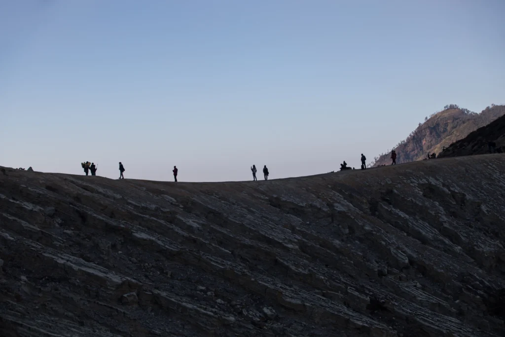
Trek from Kafnu to Mulling
- Altitude (Kafnu) : 2,450m / 8,000 ft
- Altitude (Mulling) : 3,200 m / 10,700 ft
- Trek Distance and Duration : 11 km | 7–8 hrs
- Altitude Gain : 2,700 ft
- Gradient : Moderate to Difficult
- Landscape : Forest section (silver birch, pine, and oak trees)
- Water Sources : Mountain rivers (glacial streams)
- Packed lunch for the day
- Stay in tents (twin sharing)
The actual trekking adventure begins today. You’ll wake up early in the morning and black tea will be served around 6 am. After breakfast at around 7 am, you’ll be served refreshment (juice, candy, chocolate, biscuits) for the trek. The trek will start around 8 to 8:30 am.
The trail leaves behind the civilization and enters the enchanting Bhaba valley. The trek from Kafnu to Mulling covers approximately 11 kilometres and generally takes 7 to 8 hours. The route will take you through some rarely seen sights of dense pine forests, rushing rivers, and a steady incline with some plain patches here and there.
After walking for approximately 200 meters, you’ll see the underground Bhaba Hydroelectric Power Plant. Photography is prohibited, so make sure you capture the sight in your memory. After that, the trek takes you along a motorable road in the vicinity of the Janglik Range, with the Bhaba River flowing gracefully by the trail. It leads to a place where the actual trekking route begins.
The scenery along the route is breathtaking, with wooden bridges crossing icy streams fed by glacial melt, while occasional clearings reveal panoramic mountain views. Shepherd shelters appear occasionally, which offer a glimpse into the semi-nomadic lifestyles of these people.
The path, then, gradually winds through a dense forest of silver birch, oak, and pine trees, creating a peaceful and refreshing atmosphere. The pleasant chirping of birds throughout the forest keeps your spirits high as you trek. For nearly 5.5 km, you will walk beneath the towering alpine trees, whose beauty makes the journey both soothing and unforgettable.
As you move ahead, the valley begins to narrow, and the trail continues along the left bank of the Bhaba River. After a gradual walk, the forest opens into a clearing where the terrain is covered with patches of mud, scattered stones, and stretches of grass.
After another one and a half kilometres, you will reach a beautiful campsite, Champoria, which is surrounded by dense trees and scenic mountain views. A little further, there is a bridge that you’ll have to cross to get to the right side of the Bhaba River.
From here, the trail begins to ascend gradually. The next 2 km stretch towards Jhandi Top (10,640 ft) requires a steady pace as the climb becomes more demanding. Once you reach Jhandi Top, you can take a well-deserved break and admire the breathtaking landscapes around you. From this vantage point, you can also catch the first glimpse of your next destination — Mulling. Finally, you reach Mulling at around 4 or 5 pm. A little while later, you’ll be served tea and snacks as usual. The campsite is beautifully adorned with colourful flowers, while the turquoise river flows gracefully beside it. Surrounded by lush green meadows, you can sip on a hot cup of tea as you admire the stunning sunset reflecting over the serene riverside landscape.
After taking some rest, a briefing will be conducted and your oxygen level will be monitored with an oximeter.
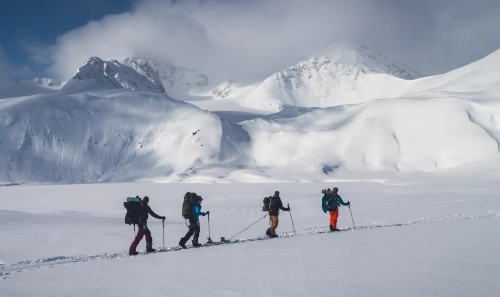
Trek from Mulling to Kara
- Altitude (Mulling) : 3,200 m / 10,700 ft
- Altitude (Kara) : 3,600 m / 11,800 ft
- Trek Distance and Duration : 6 km | 4–5 hrs
- Altitude Gain : 1,100 ft
- Gradient : Easy to Moderate
- Landscape : Rocky terrain. The last 1 km is a steep ascent
- Water Sources : Waterfall and streams
On day-3, you’ll wake up early as usual and be provided with morning tea. After breakfast and daily refreshment, the trek will start.
The route from Mulling to Kara is one of the most visually rewarding sections of this trek. Covering around 6 km in 3-4 hours, the trail gradually ascends through increasingly open terrain as the valley transforms from forested landscapes into expansive alpine meadows and glacial terrain. Today’s trek may be shorter but filled with bigger surprises. You’ll start walking on a rock path that ascends gradually for around 1.5 km until you arrive at a picturesque waterfall.
As the trail progresses, you will pass through a dense forest patch where the surroundings become perceptively darker and cooler. Soon, you will cross a stream to enter expansive meadows on the other side, where the scenery transforms into a striking and captivating landscape.
Two significant challenges are waiting for you. The first one is crossing a roaring river with icy cold water, and the second is a steep 300-meter ascent that can feel quite demanding, especially while carrying a backpack. Despite the challenges, the trail leading to the next campsite is well-defined and easy to follow.
You’ll keep ascending for approximately another 1.7 km before reaching a truly fascinating spot. A deafening sound of a rushing river will be heard here, yet the water remains hidden from sight. This is known as a subterranean river, where the river flows beneath the ground. Take a moment to admire this unique and remarkable experience. Moving ahead, the trail becomes steeper, with another challenging 1.5 km ascent ahead.
A small stone bridge greets you, which is built over a glacial stream, before the trail climbs steeply once again. After walking up the top, you’ll reach another peaceful meadow carpeted with vibrant wildflowers. Trudging along these colorful grasslands for nearly a kilometer feels truly magical as you make your way towards the next campsite.
From here, the trail gradually ascends in a zig-zag pattern across the mountainside. The final stretch of the trek requires crossing icy water once more before reaching the comforting warmth and serenity of your campsite.
The campsite may feel almost similar to the previous day’s campsite, but it has an added charm in the form of a serene lake that beautifully reflects the surrounding landscape. The Kara meadows are often dotted with shepherds grazing their cattle, adding to the peaceful mountain atmosphere.
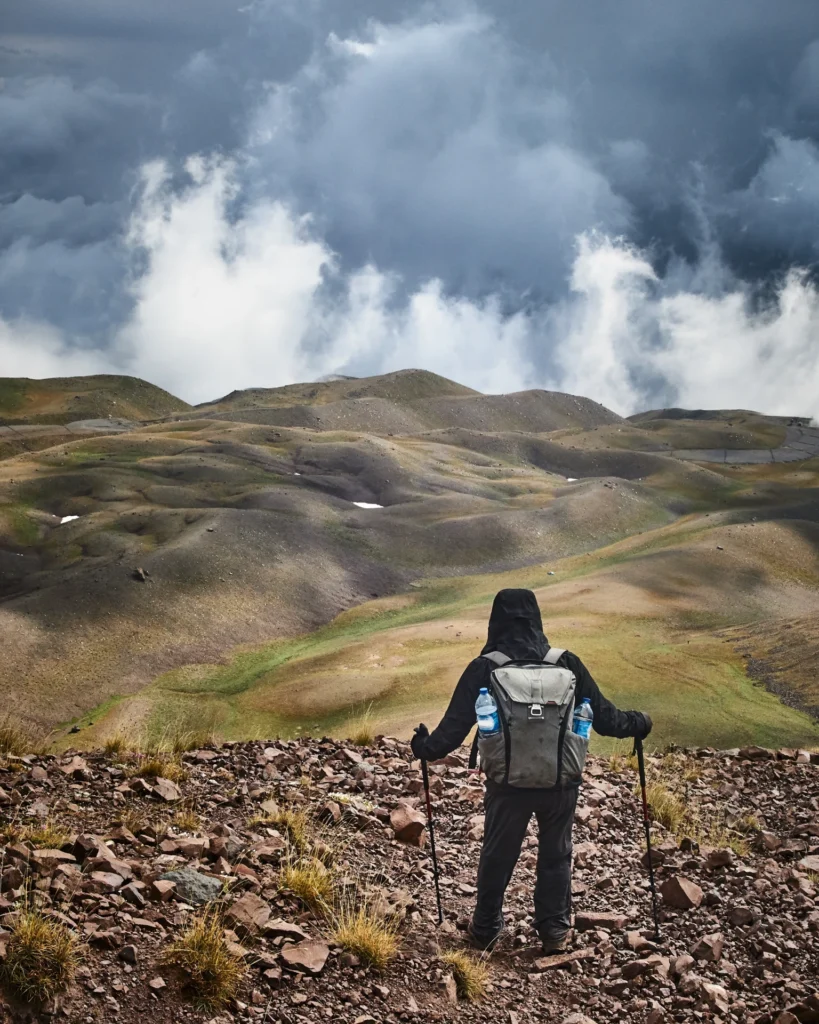
Rest and Acclimatization at Kara
- Altitude (Kara) : 3,600 m / 11,800 ft
- Kara Lake visit
- Short walks around the campsite
Day 4 is one of the most essential parts of the Pin Bhaba Pass trek, as it is devoted to acclimatization and recovery at Kara. This day is strategically critical to make sure trekkers are physically prepared for the challenging pass crossing ahead. As usual, the day will start with the morning tea followed by breakfast.
At an altitude of 3,600 m (11,800 ft), your body needs to adapt to lower oxygen levels. So, light walks around the campsite, breathing exercises, hydration, and adequate nutrition are the key. Kara is one of the most picturesque campsites on the route. With mighty peaks dominating the surrounding skyline, the campsite also features Kara Lake – a magical and serene high-altitude water body. This peaceful and breathtaking place feels surreal as the clear water of the lake reflects the mountains like a mirror.
Without the pressure of reaching another campsite, it’s a perfect day to absorb the beauty of the Himalayas. As a matter of fact, rest days are more social because trekkers interact and share stories. So, you can interact, organize gear for the pass crossing, and mentally prepare for the toughest section of the trek.
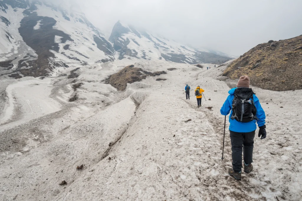
Trek from Kara to Phutsirang
- Altitude (Kara) : 3,600 m / 11,800 ft
- Altitude (Phutsirang) : 4,200 m / 13,700 ft
- Trek Distance and Duration : 5 km | 4–5 hrs
- Altitude Gain : 1,900 ft
- Gradient : Moderate with continuous ascent
- Landscape : A combination of stones and loose scree
- Water Sources : Mountain stream
Day-5 is the shortest trek, but it is both challenging and spectacular. You’ll wake up early as usual and be provided with morning tea. After breakfast and daily refreshment, the trek will start.
Covering approximately 5 km in 4 to 5 hours, the trail gains a steep altitude while entering increasingly barren and glacial terrain. The high altitude and rugged landscape make this day’s journey physically demanding.
Today, you’ll go through multiple river crossings, beginning with the Bhaba River itself and then a steep ascent. After stepping into the water, you’ll have to work as a team to comfortably get to the other side. There are as many as six streams that you need to cross before reaching the opposite side.
As you climb higher, the vegetation becomes extremely sparse, replaced by loose rocks, scree slopes, and occasional snow patches. The atmosphere is completely different from the lower valley. After climbing a few hundred feet more, the bird’s eye view of Bhaba Valley reveals its grandeur and immense scale.
The Phutsirang Nala runs on the right side while walking through this trail. This section is the combination of boulders and stream crossings. Make sure you are using trekking poles efficiently to maintain balance. There are certain sections where rocks are prone to slipping, so you have to tread cautiously and carefully on these sections.
As you approach Phutsirang, the steep ascent transitions into an open land. From here, the trail takes you to two different campsites, the lower and the upper. You have to reach the upper Phutsirang campsite, which is approximately 200 meters from here. If there is too much snow, the tents are pitched at the lower campsite; otherwise, the upper campsite is ideal.
You’ll reach Phutsirang at 1 to 2 pm in the afternoon, and you’ll be served a hot lunch. The stark beauty of Phutsirang is unforgettable. Unlike the green valleys below, this campsite feels raw, isolated, and almost otherworldly. From here, you can see Hansbeshan Peak, Nimish Khango, Tari Khango, and Pin Bhaba Pass. In the evening, you’ll be served tea and snacks. After a while, soup and snacks. Then, briefing and health monitoring with an oximeter.
Trek from Phutsirang to Bwaldar via Bhaba Pass
- Altitude (Phutsirang) : 4,200 m / 13,700 ft
- Altitude (Bhaba Pass) : 4,900 m / 16,100 ft
- Altitude (Bwaldar) : 4,080 m / 13,400 ft
- Trek Distance and Duration : 12 km | 11–12 hrs
- Altitude Gain/Loss : Gain of 2,400 ft, followed by a loss of 2,700 ft
- Gradient: Difficult : Continuous steep ascent till pass
- Landscape : The scenery changes from lush green to cold desert
Today is the most challenging as well as rewarding day of this trek. The route from Phutsirang to Bwaldar via Bhaba Pass covers approximately 12 km and takes around 10 to 12 hrs. You are going to experience one of the most dramatic Himalayan passes at an altitude of 16,100 feet.
You’ll begin your climb before dawn to take advantage of stable morning weather and firmer snow conditions. Like everyday, your morning will start with black tea and nutritious breakfast after a while.
The climb is steep and physically exhausting as you have to move across the rocky slopes, snowfields, and glacial terrain. You’ll start walking on the loose scree, and then there’ll be a continuous steep ascent until you reach the pass.
Reaching Bhaba Pass is an unforgettable moment. You’ll notice the pass forms the lowest point between the mountains. It marks the confluence of the Pin and Bhabha valleys, which is how it gets its name. From the top of the pass, you’ll witness two entirely different Himalayan worlds. On one side lies the lush green Bhaba Valley of Kinnaur; on the other lies the barren cold desert of Spiti. The contrast is extraordinary and is one of the defining features of this trek.
After soaking in the beauty around the pass and spending some time here, the descent towards Spiti begins. Then you’ll be provided with a packed lunch.
This steep downward trail is often more difficult to walk than the ascent. Snow sections, loose scree, and long descents test endurance and concentration. After descending a significant amount of distance, the landscape transforms into the dry brown and red mountains, a basic attribute of the Spiti Valley.
The Bwaldar campsite lies beside glacial streams in the stark wilderness of Spiti. After such a long and demanding day, reaching camp brings immense satisfaction. As usual, evening tea, snacks, and soup will be served. During the briefing, everyone’s oxygen level will be checked again.
Trek from Bwaldar to Mudh and Drive to Kaza
- Altitude (Bwaldar) : 4,080 m / 13,400 ft
- Altitude (Mudh) : 3,800 m / 12,500 ft
- Altitude (Kaza) : 3,700 m / 12,200 ft
- Trek Distance and Duration : 17 km | 7–8 hrs
- Drive Distance : 50 km
- Duration of Drive : 2–3 hrs
- Altitude Loss : 300 ft
- Gradient : Easy to Moderate
On day-7, you’ll wake up early as usual and be provided with morning tea. After breakfast and daily refreshment, the trek will start. The trek from Bwaldar to Mudh marks the final walking day of this journey. Covering around 17 km in 7–8 hours, the trail is mostly downhill and significantly easier compared to previous days. On this stretch of the trek, you walk on purple stones and boulders. These stones are what give this valley its pink colour, which is why the landscape is completely different and refreshing. The journey offers beautiful views of Spiti’s barren landscapes and introduces you to the unique culture of the valley.
There are multiple mountain streams that lie on this stretch. There are mostly wooden bridges to cross these streams, and the route follows a gradual descent along the rock-filled section. The whole region along this route is dominated by red soil and red stones. Soon along this route, you’ll come across Pharka village, where you can find flocks of sheep and cattle grazing in the distance. Walk for a while on this path to cross another wooden bridge, and ahead of it is the scenic Mudh village.
The Mudh village lies at the foot of this gigantic mountain, the slopes of which seem to touch the outer orbit of the earth. On the last section of this trek, you will cross the Pin River by walking on a suspension bridge. After walking the bridge, there’s a small hike up to the Mudh Village. It’s the last village of that region. After reaching Mudh, you’ll drive to Kaza, which is approximately 50 km away.
You’ll reach Kaza in the evening, which is the largest township in the Spiti region and serves as the commercial hub of Spiti Valley.
Drive from Kaza to Manali
- Altitude (Kaza) : 3,700 m / 12,200 ft
- Altitude (Manali) : 2,050 m / 6,700 ft
- Drive Distance and Duration : 200 km | 9–10 hrs
- Altitude Loss : 5,500 ft
- Breakfast and lunch on the way (not included in the cost)
Today is the last day of this trek. After the morning tea, you have to get ready for a long drive. The final leg of the journey is an epic drive from Kaza to Manali. Covering approximately 200 kilometers over 9–10 hours, this drive is considered one of the most adventurous and scenic road journeys in an extremely rugged Himalayan landscape.
This journey is unique because it covers Kinnaur to Spiti and finally to Kullu, showcasing incredible geographical diversity. You will witness how the cold desert of Spiti transitions into the vibrant valleys of Lahaul and Kullu. This drive takes you through Kunzum Pass by traversing rugged terrain filled with river crossings, glaciers, and barren landscapes. This stretch of the journey is a major highlight. Prayer flags flutter around the pass while panoramic Himalayan views stretch endlessly into the distance.
As you continue descending, the rich Himachali vegetation returns and the air becomes noticeably richer in oxygen. You are expected to reach Manali between 6:00 pm and 7:00 pm. Your trek officially concludes here, leaving you with unforgettable memories of crossing one of the most beautiful and diverse passes in the Himalayas.
Health Awareness
- Pulse rate at rest must be in between (60 to 100 beats per minute).
- Blood Pressure Reading must be in between (DIASTOLIC 75 – 85, SYSTOLIC 100 - 130 mm Hg).
- Respiratory rate at rest must be in between (12 to 20 breaths per minute).
- Should not have Liver and kidney issues.
- Should not have Diabetes Mellitus, Bronchial Asthma, Heart problems, Hypertension, etc.
- No pacemaker implant.
- People with Sinus issues, Epilepsy please contact to trek coordinator before booking the trek.
- If your BMI is not normal, Please contact our Trek coordinator before Trek booking.
Important Links
How to Reach:
Pick-Up Information
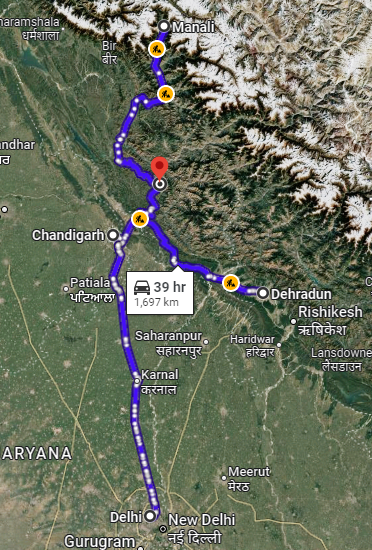
- To reach the Pin Bhaba Pass, it is necessary for everyone to travel to Shimla – the main pickup point of the trek. The meeting place is “Shimla Old Bus Stand.” Once you have reached Shimla, WTM will manage the rest of your travel arrangements only if you have opted for WTM's pick-up service. You can select this option during the booking process by adding it as an add-on (book it at least 10 days before the trek date). To avoid any kind of delays, it is advisable to reach Shimla one day earlier.
- Please Note : The most ideal and practical route to reach Shimla is from Chandigarh.
Options to Reach Shimla
Arrival by Bus:
- Shimla is very well connected by highways. HRTC buses run frequently from Chandigarh to Shimla (120 km), taking approximately 3.5 to 4.5 hours depending on traffic and the type of bus. The HRTC buses usually depart from ISBT Sector 43 in Chandigarh, which is the primary boarding hub for both Government and Private buses. You can catch AC or Non-AC buses early in the morning, in the afternoon, in the evening, and at night.
- According to the HRTC schedule, the first bus from Chandigarh to Shimla departs at 12:00 AM and the last at 08:20 PM. We highly recommend that you visit the HRTC website to check the bus schedule according to your travel plan.
- From ISBT (Kashmiri Gate), Delhi, non-AC ordinary HRTC buses run frequently to Shimla. They depart from 05:00 AM in the morning and 11:40 PM at night. The HRTC Volvo buses depart from 12:00 AM to 11:00 PM. The distance is about 340 to 360 km, which takes around 7–10 hours depending on traffic and weather.
- Note : Based on our and trekkers’ prior experience, we highly recommend you choose government buses over private buses. Government buses are generally more reliable, while private buses are more prone to delays.
Arrival by Air:
The direct flight to Shimla is only the “Alliance Air,” which usually operates from Delhi. The nearest airport to Shimla is at Jubbarhatti, which is around 22 km from the city. It’s important to note that the airstrip is small, plus the conditions here are overwhelmed by mountainous winds. Thus, flights are subject to last minute cancellations or diversions to Chandigarh.
| Location | Travelling Guide/Travel Instruction |
| Delhi | The Indira Gandhi International Airport, Delhi, is the prime airport that offers a direct flight to Shimla Airport (SLV) in Jubbarhatti. As for the airlines, the major airline that offers a direct flight to Shimla is the“Alliance Air”. From Delhi Airport, you can also opt to travel by bus as mentioned above. |
| Chandigarh | Since Chandigarh is a better option and it takes less time from here then you can book a connecting flight to Chandigarh via Delhi/Hyd/Pune/Mumbai and then book a cab or take a bus to reach Shimla. The distance between the Chandigarh Airport and the Chandigarh Bus Stand is 14 km. |
Note: After arriving at the Jubbarhatti Airport, you can book a cab or hire a taxi to Shimla, which is approximately 22 km away.
Note : Flights from Delhi to Chandigarh are often quite expensive, and even after reaching Chandigarh, you still need to continue by road to Manali. So, if you are travelling from outside Delhi and considering a flight to Chandigarh, you may want to opt for a more economical alternative instead. If you have sufficient time, travelling by road from Delhi to Manali is both comfortable and scenic. You can take an overnight or morning bus from ISBT Delhi, or hire a private cab directly to Manali.
Note: The flights to Jubbarhatti are highly dependent on the weather conditions and seasonality. So, we firmly advise you to arrive a day or two before your trek. Also, due to the same reason, most travelers instead fly to Chandigarh or Delhi and then continue by road.
Arrival By Train
Shimla doesn’t have a standard broad-gauge railway station and tracks that can connect to the mainland railway stations. However, major regular trains go to Kalka, which is the classic railway route to Shimla. Moreover, Kalka railway station is well-connected to Delhi, Chandigarh, Kolkata, and Mumbai.
After reaching Kalka, you can board a bus or hire a taxi to Shimla.
Another nearest railway station to Shimla is Chandigarh Railway Station. From there, you can travel to ISBT Sector 43 (approximately 10–11 km), and then you can take an overnight bus to Manali.
How to Reach Kafnu
The road journey from Shimla to Kafnu is about 200 km and normally takes 7–10 hours, depending on the weather and road conditions. You can reach Kafnu village by any direct HRTC bus. These buses depart from Shimla ISBT or Old Bus Stand.
The route is: Shimla → Narkanda → Rampur → Jeori → Wangtoo → Kafnu
This mode is best for budget travelers, solo trekkers, backpackers, etc.
Another way is by shared taxi or shared Jeep. This is the most common option for trekkers heading to Pin Bhaba Pass.
Drop-Off Information
- The designated drop-off point is the Manali Old Gov bus stand around 6:30 pm to 7:30 pm .
- Please consider planning your subsequent travel arrangements after 8:00 pm.
- It's highly advisable to keep a buffer day in your travel plan. If the buffer day is not needed, it can be used to explore Manali.
- WTM offers comfortable transportation through Tempo Traveler, Bolero, or equivalent vehicles. If you wish to upgrade your mode of transportation, please contact your trek coordinator for further assistance.
Cost Terms
1. Accommodation (as per the itinerary)
- Guesthouse in Kafnu on Day 1 (triple/quad sharing basis, males and females separate).
- Guesthouse in Kaza on Day 7 (triple/quad sharing basis, males and females separate).
- Camping during the trek from Day 2 to Day 6 (twin sharing basis).
2. Meals (Veg + Egg)
- Meals from Kafnu to Bwaldar.
- Day 1 dinner to Day 7 packed lunch.
3. Support
- 1 versatile base camp manager: handles communication and deploys extra manpower in emergencies.
- 1 mountaineering and first aid qualified professional trek leader.
- 1 experienced high-altitude chef.
- Local experienced guides (number of guides depends on the group size).
- Adequate support staff.
4. Trek Equipment
- Sleeping bag, sleeping liners (if needed), mattresses, and utensils.
- 3-person all-season trekker tent (twin sharing), kitchen and dining tent, toilet tent.
- Camping stool, walkie-talkie.
- Ropes, helmet, ice axe, harness, gaiters, and crampons (if needed).
5. First Aid
- Medical kit, stretcher, oxygen cylinder, blood pressure monitor, oximeter, stethoscope.
6. Mules/porters to carry the main luggage.
7. All necessary permits and entry fees, up to the amount charged for Indians.
8. Services from Kafnu to Kaza.
9. Trek completion certificate.
- Insurance (For non-Indian Nationals, NRI or OCI card holders).
- Food during the transit.
- Any kind of personal expenses.
- Mule or porter to carry personal luggage.
- Emergency evacuation, hospitalization charge, etc.
- Any extra costs incurred due to extension/change of the itinerary due to natural calamities roadblocks, vehicle breakdown, etc. factors beyond our control
- Transportation (as per the itinerary):
- Shimla to Kafnu (day 1).
- Kaza to Manali (Day 8).
- Anything not specifically mentioned under the head Inclusion.
Trek Essentials
| Backpack with rain cover | (40 – 50 ltr) with comfortable shoulder straps |
| Day pack with rain cover | 20 – 30 ltr (If off-load opted) |
| Walking stick | Advisable (At least one) |
| Water Bottle / Hydration pack | 2 bottles of one liter each, People who use hydration pack 1 hydration pack and 1 bottle of one liter, Carry at least one thermos flask. |
| Small size tiffin/lunch box | 1 Nos |
| Snacks | Energy bars, dry fruits, electral/ors |
| Personal Medical Kit | Consult your doctor |
| T-Shirt (Synthetic quick dry) | 1 Full & 1 Half sleeves |
| Fleece T-shirt | 1 Nos |
| Fleece jacket | Not required |
| Windproof Jacket | 1 Nos |
| Down feather / Hollow jacket | 1 Nos |
| Thermal inner (Upper and Lower) | 1 Pair |
| Trek Pant (Synthetic quick dry) | 1 Nos |
| Fleece Pant | Not required |
| Waterproof gloves | Not required |
| Fleece / woollen gloves | 1 Pair |
| Poncho / waterproof Jacket and pant | 1 Nos |
| Head torch | 1 Nos. (Avoid Hand torch) |
| Sun cap | 1 Nos. (One that covers the neck as well) |
| Woolen cap | 1 Nos. |
| Balaclava | Not required |
| Buff / Neck-gaiters | 1 Nos. |
| Sunglasses | UV with dark side cover, People who wear spectacles – (A)- Use contact lenses | (B)- Photo chromatic glasses |
| Trekking shoes | 1 Pair (Water-resistant, high ankle with good grip) |
| Floaters / flip-flops | 1 Pair |
| Cotton socks | 6 pairs |
| Woollen socks | 1 pairs |
| Gaiters | 1 Pair (WTM provides when required) |
| Micro spikes | 1 Pair (WTM provides when required) |
| Sunscreen cream | 1 Nos |
| Moisturiser | 1 Nos |
| Chap-stick / Lip balm | 1 Nos |
| Toothbrush and toothpaste | 1 Nos |
| Toilet paper & Wipes | 1 Nos |
| Soap / hand sanitizers | 1 Nos |
| Antibacterial powder | 1 Nos |
| Quick dry towel | 1 Nos |
Gallery
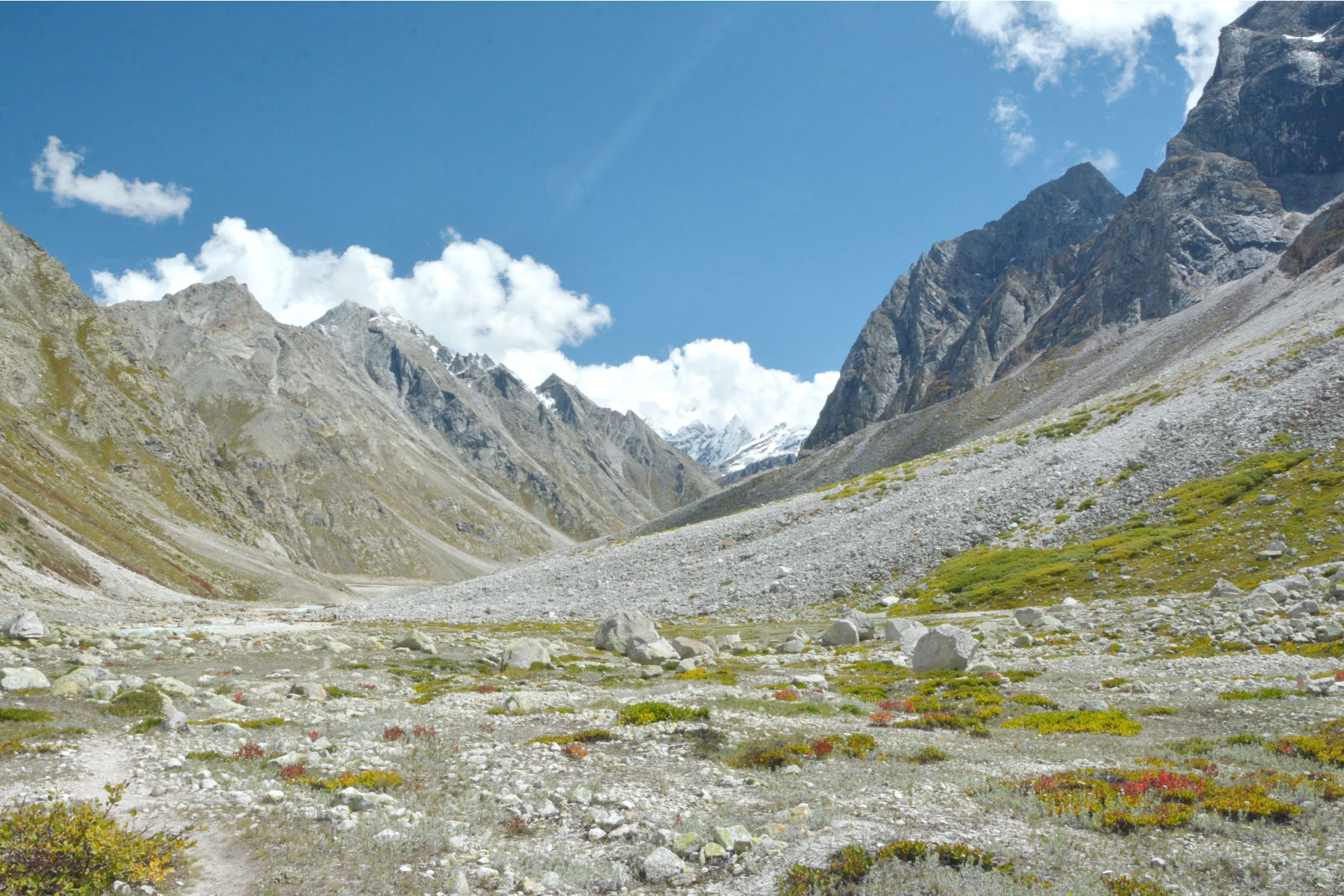
Cancellation Terms
To request a cancellation, please email us at info@walkingthemountains.com using your registered email ID.
Cancellations prior to 28 days from the start of the Trip
Refund Options
- 5% deduction of trek fee
- 100% trek fee cash voucher for any trip until six months from the date of last trek.
- Transfer your trek (any trek, any date) to your friend
Cancellation between 27 days and 15 days to the start of the Trip
Refund Options
- 30% deduction of trek fee
- 100% trek fee cash voucher for same trip till one year
- 85% trek fee cash voucher for any trip till one year
Cancellation between 14 days and 8 days to the start of the Trip
Refund Options
- 50% deduction of trek fee
- 80% trek fee cash voucher for same trip till six months.
- Book the same trek, in the same season, with any other batch
- Transfer your trek (same trek, any date) to your friend
Cancellation less than 7 days to the start of the trek.
Refund Options
- No cash refund
- 20% trek fee cash voucher for the same trip until six months.
Itinerary and Modifications
- WTM reserves the right to modify, shorten, or cancel any part of the Trip due to transportation delays, weather, health emergencies, or other unforeseen circumstances including Force Majeure.
Cancellations and Refunds
- No refunds or vouchers, partial or otherwise, shall be provided for voluntary withdrawal, non-utilisation of services, or removal from the Trip.
- If WTM cancels the Trip before arrival at the designated pick-up point due to unforeseen circumstances or Force Majeure, the Participant may choose from:
- An alternate Trip/date.
- A credit voucher valid for one (1) year.
- Transfer to another Trip, with cost differences payable by the Participant.
- If the Trip is abandoned post-arrival at the designated pick-up point, no cash refund or voucher shall be issued. The Trek Again Policy may apply at WTM’s discretion.
- WTM shall not be liable for any associated travel costs such as flights, accommodation, or visa fees.
Force Majeure
- Events beyond its control including but not limited to earthquakes, landslides, strikes, curfews, war, pandemic, government restrictions, heavy rainfall or snowfall, windstorms, road blockages, trail disruption, or withdrawal of permits, WTM shall not be held liable for any cancellation, delay, or service modification caused by Force Majeure.
FAQ’S
The best time to do the Pin Bhaba Pass trek is during the monsoon months, from July to mid-September. This is when the trail is at its most beautiful, with lush greenery on one side and barren, colorful landscapes on the other. During this period, the pass is usually free of excessive snow, the weather is pleasant, and the views are vibrant and contrasting.
Pin Bhaba Pass trek is considered to be of moderate to difficult difficulty level. For the most part, the trail is gradual and manageable, passing through scenic meadows, forests, and river crossings. However, the summit day, when you actually cross the Pin Bhaba Pass at a high altitude and wake up in the wee hours is the most challenging part. It truly tests your stamina, determination, and ability to adapt to changing weather. So while the trek is doable with preparation, it does require good physical fitness and mental strength.
Pin Bhaba Pass Trek is full of amazing and unforgettable moments. One of the biggest thrills is crossing the Pin Bhaba Pass itself, which connects the lush green Bhaba Valley of Kinnaur with the barren, colorful desert landscape of the Pin Valley in Spiti. The dramatic contrast in landscapes on either side of the pass is truly mesmerizing. You also get to camp at beautiful spots, cross multiple glacial streams, walk through alpine meadows, and witness majestic mountain views every day.
Along the way, you’ll get a taste of the local culture and traditions of both Kinnauri and Spitian people, which adds a rich cultural experience to the trek. All of this makes the Pin Bhaba Pass Trek not just a physical journey, but also a deeply rewarding one.
Permits such as Inner Line Permit, National Park Permit, and Forest Permit. When you are with us, we obtain all the permits for you.
We recommend that you withdraw all necessary cash in Shimla, as it has reliable ATM facilities. However, if you miss doing so, the last ATM available is in Rampur. Keep in mind that ATMs in remote areas can sometimes be out of cash or not working, so it’s best to carry enough money from Shimla itself for the entire duration of the trek and your travel after that.
No, there is no electricity or charging point available once the trek begins. The last place where you can charge your devices is Kafnu, the starting point of the trek. After that, you’ll be camping in remote areas without access to electricity.
Yes, offloading services are available on the Pin Bhaba Pass Trek. If you're not comfortable carrying your backpack, you can hire a porter or use a mule service to carry your load for you. This helps you trek more comfortably, especially at higher altitudes or on steep trails.
Pin Bhaba Pass trek is generally not recommended for absolute beginners. However, if the beginners have a good level of physical fitness and are prepared for the challenges of high-altitude trekking, then it can be suitable for them as well. For beginners, the trek can feel demanding due to the rapidly changing terrain and altitude gain. It also involves long trekking days, steep ascents, river crossings, and a high-altitude pass crossing at around 16,100 feet.
One of the unique aspects of this trek is that it passes through two completely different Himalayan regions — the lush Bhaba Valley in Kinnaur and the cold desert landscape of Spiti Valley. Because of this, trekkers experience a wide range of weather conditions within just a few days. You may encounter warm sunshine, rain, icy winds, freezing nights, and even snowfall depending on the season and altitude.
This trek passes through the breathtaking Pin Valley National Park. This region is home to Himalayan wildlife such as ibex, blue sheep, marmots, Himalayan griffons, and occasionally snow leopards in the Pin Valley region.